This guide is the companion to the special issue of ERETZ Magazine, The Jordan: Biography of a River, and presents a selection of sites, attractions, and villages along the entire length of the river. In an effort to provide you with a light, portable, convenient guide to use while traveling along the Jordan River, as compared to a thick, heavy tome, we tried not to stray too far from the river’s banks in determining what to include while doing justice to the sites we see as the most interesting. The resulting guide includes settlements, archaeological sites, nature attractions, and destinations that have a unique story.
The guide is organized into three sections: The headwater – From Mount Hermon to the Sea of Galilee; Jordan Valley North – From the Sea of Galilee to the Beit She’an Valley; Jordan Valley South, from the Beit She’an Valley to the Dead Sea. The site numbers match their numbers on the map.
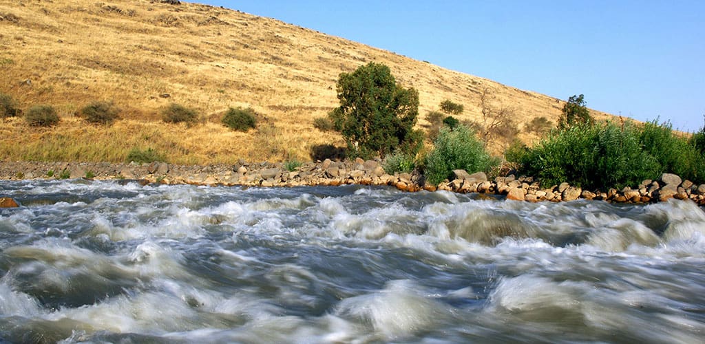
The northern part of the Jordan River, from its sources until it enters the Sea of Galilee, is almost completely straight. This section of the river slopes steeply downward as it flows toward the lake. After the Hula Swamp was drained in the early 1950s, the current in this part of the river became faster and it became almost completely free of twists and turns. In contrast, the lower part of the Jordan that extends from the Sea of Galilee to the Dead Sea flows through the floodplain known in Hebrew as Geon Hayarden and in Arabic as the Zhor. The river twists and turns so much in the expanse between the two series of cliffs flanking the flood plain that it meanders for some 250 kilometers to traverse a distance that is only 100 kilometers as the crow flies.
The loops and curves of the river are not set in stone, but change from time to time as the river carves its way through the soft marl. As a result, the meanders become increasingly narrower until one end of the meets the other, forming a small pond, cut off from the river, called an oxbow lake. The river, for its part, continues along its new, straight channel until it carves another loop for itself. This process causes the channel of the riverbed to meander around and triggers rockslides that sometimes halt the flow of the river for a few hours, providing enough time for the entire people of Israel, or at least Elijah or Elisha, to cross the river without getting wet. This process is gradually moving the entire riverbed westward so the monasteries that were built on its eastern bank in the sixth century CE are no longer by the water.
Today the upper part of the channel is easily accessible, while the lower part is more complicated to reach. The Israeli side of the Jordanian floodplain is behind fences and the eastern side is under the control of Jordanian military, so access to the water is obstructed on both sides. This actually is a mixed blessing as it allows the flora and fauna in the area to flourish. Since the peace agreement between Israel and the Hashemite Kingdom of Jordan in the 1990s, Israeli military activities on the western side of the Jordan have been reduced and the abandoned IDF outposts have become home to tens of thousands of bats, including species that were thought to be extinct. Wild boars blaze trails for themselves in the marl hills, foxes, wolves, and even leopards lounge in the tangle of greenery by the banks, songbirds nest on the cliffs, falcons take up positions atop the cliffs, and migrating birds – from raptors to waterfowl – find abundant food and shelter alongside the channel of the river.
Little water flows in the final stretch of the Jordan River, especially in the summer. Today the State of Israel’s main river, the one that so many songs have been written about in Hebrew and English, actually is just an unimpressive trickle that swells briefly when winter rains flood its tributaries. As the amount of water in the river dwindles, the Dead Sea shrinks in kind. Over the past three decades, the level of the Dead Sea has fallen by at least 30 meters, causing its northern coast to recede two kilometers.
Due to its role as a border for most of the years that the State of Israel has existed, the Jordan River has become a fringe area that hikers rarely explore. However, it is one of the most fascinating and interesting landscapes in the Land of Israel. I hope that the combination of the special issue on the Jordan River and this guide will encourage you to get to know, preserve, and enjoy one of the world’s most famous rivers.
Yadin Roman