Blue Skies, Blue Walls, Blue Eyes

Zefat

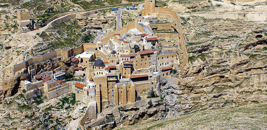
It was midnight in the ancient cemetery of Safed on a dark, moonless night. It was rosh hodesh, the beginning of the month according to the Jewish calendar, and a sliver of the new moon had yet to make its first appearance. Instead of moonlight, hundreds of memorial candles illuminated the cemetery, their small flames flickering against the sky-blue tombstones of the tzaddikim on the mountain slope. As always, on the first night of the month, the cemetery hummed with supplicants; masses of them had gathered on the plaza near the tomb of Isaac Luria Ashkenazi, who is commonly known by his acronym, the Ari (Hebrew for the lion). Murmurs of private prayers rose from the plaza and were joined by those coming from the darkness in other parts of the cemetery.
The mikve of the Ari was full. Men were immersing themselves in the freezing water that tumbles out of a small channel in the rock into the ritual bath. A line of black hats hung from the hooks along the wall, together with long black coats, long white undergarments, and tassels of tzizit. It was a regular rosh hodesh night in the spiritual capital of Galilee.
A local tradition in Safed recounts that when the Herzliya hotel was built there in 1925, the workers found a prehistoric skull with an arrow embedded in it lodged in the hollowed-out, thousand-year-old olive tree in the hotel garden. Old-timers consider this an indication of how ancient this city is. The spiritual and national leaders of the nascent Jewish community in Palestine holidayed there every summer, reclining on armchairs in the shade of this ancient olive tree.
Hayyim Nahman Bialik, the national poet, came. So did Meir Dizengoff, the first mayor of Tel Aviv, painters Man-Katz and Reuven Rubin, actress Hanna Rovina, and many more. In the 1930s, Safed was the leading resort in the Land of Israel. Thousands flocked to the town in order to spend the hot, humid summer months in the cool, clear mountain air of the Upper Galilee. Dozens of hotels, numerous restaurants, and a wealth of dance halls and night clubs attended to them. In 1933, Kaete Dan, scion of a famous Berlin family of hoteliers, took up residence in Safed. The hotel that she built was the most modern in the land; it provided not only accommodations and food, but also an entertainment team that included belly dancers and hostesses from Beirut. Her establishment thus recreated the merry atmosphere found in the capital of the Weimar Republic.
In the first decade after the founding of the State of Israel, the country’s leading artists established the Artists Colony in the city’s picturesque abandoned Arab houses. Painters such as Isaac Frenkel, Sionah Tagger, Menahem Shemi, Azriel Awret, Moshe Castel, Arieh Merzer and many others took up residence in the derelict stone houses. Art lovers subsequently joined the annual crowds of summer tourists, coming to the town to browse around the studios and galleries. In the 1960s, Safed became the summer abode of Israeli bohemia and a long line of night clubs began to operate in the old city – all open until the early hours of the morning. The most famous was the Sha’ot Haketanot (Hebrew for “the Wee Hours”), but others like Canaan Nights, the Fortress Club, the Vault Club, the Bedouin Tent, Moulin Rouge, Milo Club, and more made Safed into a very lively place. The foremost entertainers in Israel appeared here: Alexander Yahalomi, Zadok Savir, Shoshana Damari, Shai K. Ophir, and Yaffa Yarkoni, among others. The famous Tarnegolim troupe regularly performed on the small club stages and the Gashash Hahiver, soon to become an icon of Israeli culture, took its first steps here. Cabaret entertainment flourished, including nude dancers that arrived straight from the famous Moulin Rouge club in Haifa. From the middle of the 1960s, festivals were added to the range of attractions. The first international film festival in the country was held in Safed, together with festivals dedicated to various musical instruments.
As the 1970s came to a close, tourism to Safed crashed. Air conditioning allowed other resorts to compete with the cool air of the mountains and the relaxation of foreign currency restrictions on Israelis made travel abroad an increasingly tempting option for them. The political atmosphere during Israel’s first decades had not looked favorably on the hotel owners of Safed. Independent tourism establishments owned by private entrepreneurs who were not connected to the socialist elite that ran the country had to compete with the hotels and resorts that mushroomed in the kibbutzim run by people with better government connections. The new competition, boosted by sponsored vacations for government employees and workers in cooperative factories, also curbed the number of visitors to Safed. Gradually, the hotels closed, the night clubs shut their doors, and the artists, now much older, moved to Tel Aviv.
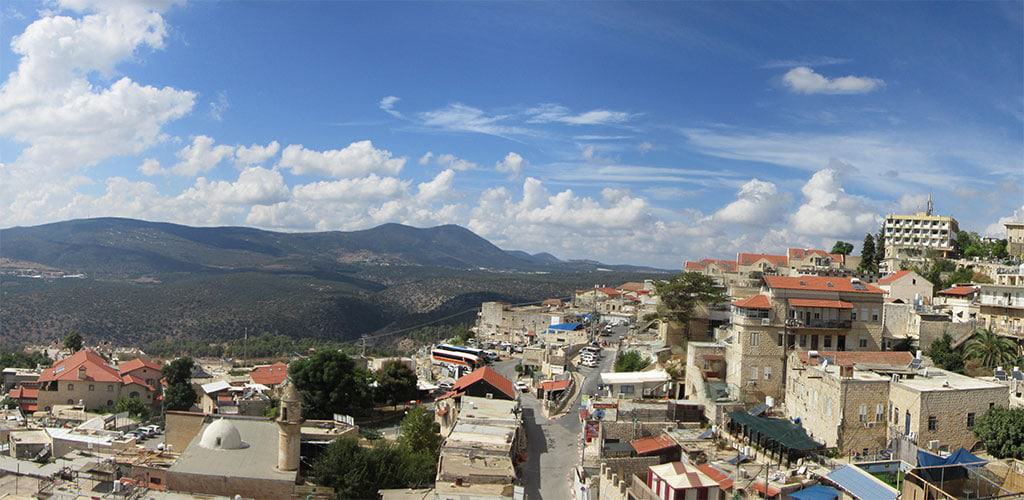
Despite this, Safed’s appeal and charm remained; it was kept alive by its warm spontaneous hospitality, blue-painted alleys, and ancient synagogues. At the turn of the twenty-first century, an attempt was made to rejuvenate its tourism industry. A government-sponsored tourism administration was created, new bed-and-breakfast establishments were encouraged, and a few hotels were refurbished. But the government investment did not bring about the desired turnaround and soon budgets dwindled and the city sunk into travel limbo.
Safed today is not your usual tourist destination. There are no marketing campaigns, formal tourism sites, or shopping centers. The gems of Safed are secluded and it is up to the visitor to discover them. The city’s charm peeks out from behind ancient iron gates and from its enclosed courtyards, galleries, small museums, synagogues, and quaint coffeehouses.
Safed is full of stories whose sources have been obscured by time; they may be traditions or legends and some may even be true tales. One tells of a couple that came for a visit. When they could not find the room that they had reserved, they asked a local passerby for directions. He escorted them to the place and then beseeched them to come to his house for a Shabbat meal. That evening, the two sat down to dinner with their newfound host and ended up singing Shabbat hymns with him until the middle of the night. Then their new friend gave them a night tour of Safed.
“That is not out of the ordinary,” the people of Safed will say, “inviting a traveler into your home is part of the local tradition.”
Havdalah candles, visitors to the candle factory in Safed will be told, must have at least two wicks – just like Safed, with its intertwined traditions of kabbalah and mysticism on the one hand and traditional hospitality on the other.
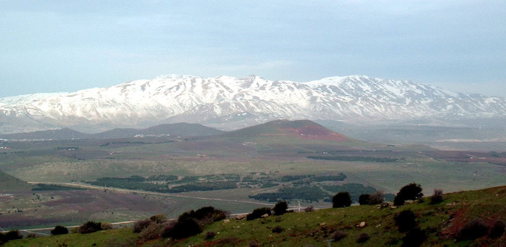
“Three things captured my heart,” rabbi Solomon Molcho wrote 340 years ago to his beloved in Safed, “the blue skies of Galilee, the blue walls of Safed, and the blue of your eyes.”
This too is the key to the romance of Safed: the coming together of great beauty.

The Village Spring

Nazareth01

Noon in the Nazareth market, the largest open-air market in Israel. The two small tables at Abu Mahmoud’s coffee shop are full. A backgammon game is in full swing at one. At the other table, four card players are intensely focused on their hands. Water bubbles in the water pipes and thick black coffee residue coats the bottom of the traditional coffee cups – the little, handle-less porcelain cup known as a finjan in Arabic. The pleasant atmosphere quietly fills with that hint of suspicion that arises when members of different Israeli sectors meet.
“Tfadalu [welcome],” Abu Mahmoud says, inviting us inside with a wide smile that immediately breaks the ice.
The Tel Aviv members of our small group order bottled soft drinks from the refrigerator standing in the large domed room of the coffee shop. The veterans of many a trip around the country order coffee – black, freshly brewed, and spiced with cardamom from the market. We sit on cushioned benches along the wall and sip from the small porcelain cups.
“Are you from Nazareth?” we ask, the most banal of questions, yet a good opening line for many a conversation.
“Of course,” comes the answer from both tables.
We continue with the Hebrew catchphrase, Ma Hamazav? It literally means, “What is the situation?” but actually means, “How is everything with you?” leaving many options for an answer, from the personal to the general state of the Middle East. The silence in the room turns into a conversation.
“Nazareth is not a city,” our hosts explain. “It is a village, a village that has expanded, developed, and broken out in all directions. But at its base, it remains a village.”
And villages all over the world are the same. They have close-knit clans, historic feuds, and memories of forbidden love stories and sordid betrayals that go back for generations. In Nazareth, however, the feuds and love stories are between Muslims and Christians, Jews and Muslims, Christians and Jews, and all other possible combinations between the three faiths that believe in one God.
As a village, Nazareth’s fame spread around the world. This Galilean hamlet is where the Holy Family lived. Here, the archangel Gabriel announced to the young Mary that she was about to give birth to a son. The father of the boy was not her husband Joseph, but the Holy Spirit. History did not record what the wagging tongues of the village had to say about this pregnancy. They may have mentioned that Joseph was not originally from Nazareth. He had come there from afar, from Bethlehem in Judea. It is unclear what brought Joseph to Nazareth during the last years of Herod’s reign. The elderly king was about to die and winds of a dynastic battle and popular uprising were in the air. Maybe Joseph thought it was better to move to the countryside, to get away from the unrest brewing around Jerusalem.
Perhaps he came to seek work at the grand building projects of Herod Antipas, Herod’s son and the ruler of Galilee who was planning to build a new capital for the Galilee by renewing abandoned, destroyed Sepphoris on the great road trunk from Acre to Damascus. Sepphoris was less than three miles from Nazareth and would have attracted builders and carpenters as well as stonemasons from around the country. Joseph, who was a wood worker, would have found ample employment in the magnificent mansions going up in Sepphoris. What the young Jesus – then a popular shortened version of the name Joshua – did in his early years in Nazareth is unknown. Maybe he accompanied his father on the 40-minute walk to Sepphoris, where later traditions would place the home of Mary’s parents, and helped him with his work.
The scriptures and the early Christian historians have left very few details on Jesus’ life in Nazareth. However, once Christianity began to spread, in the second and third centuries CE, Nazareth began to attract increasing numbers of pilgrims, and the little hamlet in Galilee added pilgrimage to agriculture as a source of livelihood. Even though Christians make up the bulk of the tourists who come to Israel today and Nazareth is chock full of churches, monasteries, and other Christian sites, the city is not flourishing as a tourist destination. Tourists rush through it, staying for only a few hours on average, and then off they go to another destination in the Galilee.
As a Muslim city, Nazareth saw more success. During the eighteenth and nineteenth centuries, wealthy Arab families settled in the town and built large mansions in it – beautiful houses with painted ceilings and stucco ornamentation in the style of traditional Turkish-Lebanese architecture. During the final years of the Ottoman Empire and the British Mandate, Nazareth developed as the administrative and economic center of the Galilee, with the offices, services, and businesses that accompany a center of power.
The Israeli War of Independence and the first decades of the State of Israel were not kind to Nazareth. Refugees from the Arab villages of Galilee crowded into the town, settling in neighborhoods that became known by the names of the uprooted families’ villages. The new Israeli authorities looked on the town as a backwater for political dealings, creating a series of local Arab parties that mainly supported the leading labor parties that ruled Israel.
In 1956, following a plan to settle more Jews in the Galilee, land from Nazareth and the surrounding Arab villages was expropriated to create a Jewish town overlooking Nazareth, which was dubbed Nazerat Illit (Upper Nazareth).
Despite all this, Nazareth continued to grow and develop. Farming was no longer an option as much of its land had been expropriated, but the schools of the Christian organizations and institutions gave rise to an educated, professional population that supported itself very well in the modern economy of Israel by supplying professional, trade, and local government services. Meanwhile, the second and third generations of Israeli Arabs were learning how to demand their share of government funds and take their rightful place in the country’s political structure. Nazareth prospered and soon became the largest Arab city in Israel with a population of over 100,000.
Despite its fame worldwide, Nazareth remains an undiscovered travel destination. Its alleys are magical, filled with traditional workshops and ancient mansions. It boasts a unique and lively culinary scene, with some of the best restaurants and coffee shops in Israel. The walls of the monasteries and churches hide serene, beautiful gardens where nuns and monks have secluded themselves in order to seek peace and serenity in a world dedicated to faith and prayer. The painted ceilings adorning the mansions of the Old City artistically depict scenes from days long gone, while colorful, symbolic icons adorn its many churches, which represent an amazing variety of traditions. The Anglican Church looks as if it were transplanted from an old English parish. The mosques invite the visitor to rest in their carpeted prayer halls. Then there is the hummus. It is definitely the best in the country – ask all the bus and truck drivers from all over the country who make sure to stop at one of the many hummus eateries in Nazareth whenever they are in the Galilee.
This guide attempts to shine some light on the magic of this still unknown place. It is an invitation to the reader to stroll through the alleys, to venture away from the beaten path, and to spend the night.
As Abu Mahmoud greets visitor to his coffee shop, “Tfadalu,” and be enchanted by this very special place.

Song of the Jordan

jorden02

This guide is the companion to the special issue of ERETZ Magazine, The Jordan: Biography of a River, and presents a selection of sites, attractions, and villages along the entire length of the river. In an effort to provide you with a light, portable, convenient guide to use while traveling along the Jordan River, as compared to a thick, heavy tome, we tried not to stray too far from the river’s banks in determining what to include while doing justice to the sites we see as the most interesting. The resulting guide includes settlements, archaeological sites, nature attractions, and destinations that have a unique story.
The guide is organized into three sections: The headwater – From Mount Hermon to the Sea of Galilee; Jordan Valley North – From the Sea of Galilee to the Beit She’an Valley; Jordan Valley South, from the Beit She’an Valley to the Dead Sea. The site numbers match their numbers on the map.
The northern part of the Jordan River, from its sources until it enters the Sea of Galilee, is almost completely straight. This section of the river slopes steeply downward as it flows toward the lake. After the Hula Swamp was drained in the early 1950s, the current in this part of the river became faster and it became almost completely free of twists and turns. In contrast, the lower part of the Jordan that extends from the Sea of Galilee to the Dead Sea flows through the floodplain known in Hebrew as Geon Hayarden and in Arabic as the Zhor. The river twists and turns so much in the expanse between the two series of cliffs flanking the flood plain that it meanders for some 250 kilometers to traverse a distance that is only 100 kilometers as the crow flies.
The loops and curves of the river are not set in stone, but change from time to time as the river carves its way through the soft marl. As a result, the meanders become increasingly narrower until one end of the meets the other, forming a small pond, cut off from the river, called an oxbow lake. The river, for its part, continues along its new, straight channel until it carves another loop for itself. This process causes the channel of the riverbed to meander around and triggers rockslides that sometimes halt the flow of the river for a few hours, providing enough time for the entire people of Israel, or at least Elijah or Elisha, to cross the river without getting wet. This process is gradually moving the entire riverbed westward so the monasteries that were built on its eastern bank in the sixth century CE are no longer by the water.
Today the upper part of the channel is easily accessible, while the lower part is more complicated to reach. The Israeli side of the Jordanian floodplain is behind fences and the eastern side is under the control of Jordanian military, so access to the water is obstructed on both sides. This actually is a mixed blessing as it allows the flora and fauna in the area to flourish. Since the peace agreement between Israel and the Hashemite Kingdom of Jordan in the 1990s, Israeli military activities on the western side of the Jordan have been reduced and the abandoned IDF outposts have become home to tens of thousands of bats, including species that were thought to be extinct. Wild boars blaze trails for themselves in the marl hills, foxes, wolves, and even leopards lounge in the tangle of greenery by the banks, songbirds nest on the cliffs, falcons take up positions atop the cliffs, and migrating birds – from raptors to waterfowl – find abundant food and shelter alongside the channel of the river.
Little water flows in the final stretch of the Jordan River, especially in the summer. Today the State of Israel’s main river, the one that so many songs have been written about in Hebrew and English, actually is just an unimpressive trickle that swells briefly when winter rains flood its tributaries. As the amount of water in the river dwindles, the Dead Sea shrinks in kind. Over the past three decades, the level of the Dead Sea has fallen by at least 30 meters, causing its northern coast to recede two kilometers.
Due to its role as a border for most of the years that the State of Israel has existed, the Jordan River has become a fringe area that hikers rarely explore. However, it is one of the most fascinating and interesting landscapes in the Land of Israel. I hope that the combination of the special issue on the Jordan River and this guide will encourage you to get to know, preserve, and enjoy one of the world’s most famous rivers.

Yadin Roman

The Road to Jerusalem

Latrun-Monastery

Latrun Fortress
In the middle of the valley, on a hill to the south of the road, stands the British police fort of Latrun. It was built in 1941 as part of a series of similar British fortresses, all known as Taggart Forts after their planner. On the eve of the War of Independence, the British handed the fortress over to the Jordanian Arab League, thus effectively blocking any Jewish approach to Jerusalem. Attempt after attempt of the Israel Defense Forces to capture the fortress and open the road to Jerusalem failed. Finally, a way to build a track that would circumvent the fortress was found. The road through the mountains was called the “Burma Road.” The fortress remained in Jordanian hands until the Six Day War. The site today is a memorial to the Israeli Armored Forces.
Latrun Monastery
On the hill behind the fortress is the Trappist Monastery of Latrun. The monastery was built in 1890 and has vineyards and an extensive farm. The Trappists are sworn to a vow of silence.
Latrun Castle
On the hill above the monastery lie the remains of the Crusader castle of Latrun. The castle was built in 1150 and called “Le Toron des Chevaliers.” The hill on which the castle was built was believed to be the hill where the home village of the good thief, who was crucified with Jesus, once stood. The castle was also known as “Castrum Boni Latronis” – the castle of the good thief.

Getting to Jerusalem is very much a part of your visit to the city. A modern highway, Route 1, leads to Jerusalem from the west – from Tel Aviv and the Ben-Gurion International Airport – and this is the route taken by most visitors to the city today. However, the approach from the west has been the main road to Jerusalem only for the last 200 years. Before that, most travelers arrived at the gates of Jerusalem either from the north or the south, along the ancient Way of the Patriarchs, that ran along the mountain backbone in the center of the country; they also primarily arrived from the east – from the direction of Jericho – which was the main route to Jerusalem from the Galilee and from across the Jordan.
One of the reasons that the approach from the west was never popular was the need to negotiate the relatively steep slopes of the Judean Mountains via one of three narrow defiles that led up the mountain. Many an army fleeing from Jerusalem was ambushed in these narrow defiles and many a traveler was robbed by brigands along the way. The northern and southern ascents – via Beit Horon in the north and via the Valley of Ela in the south (the place where David fought Goliath) – still have remains of the Roman military roads that ran along them. The one in the center, along the Valley of Sha’ar Hagai, is used today by Route 1.
Most people on the road to Jerusalem whiz by the many interesting sites on the way. Following are a few pointers to some of them – to make the best out of the journey into the city.

The Ayalon Valley
Once out of the coastal plain and over the low foothills that run along the foot of the Judean Mountains, the highway curves through a large plain – this is the Ayalon Valley, the place where the sun stood still so that Joshua could complete his victory against the five Amorite kings. The large flat valley has been a battle site for generations. Egyptians, Greeks, Hasmoneans, British, Israelites, and Jordanians have all fought major battles in this valley. At the end of the War of Independence the valley was divided between Israel and Jordan, the exact border running along the edge of the farthest field that each side managed to plow.

Latrun Fortress
In the middle of the valley, on a hill to the south of the road, stands the British police fort of Latrun. It was built in 1941 as part of a series of similar British fortresses, all known as Taggart Forts after their planner. On the eve of the War of Independence, the British handed the fortress over to the Jordanian Arab League, thus effectively blocking any Jewish approach to Jerusalem. Attempt after attempt of the Israel Defense Forces to capture the fortress and open the road to Jerusalem failed. Finally, a way to build a track that would circumvent the fortress was found. The road through the mountains was called the “Burma Road.” The fortress remained in Jordanian hands until the Six Day War. The site today is a memorial to the Israeli Armored Forces.

Latrun Monastery
On the hill behind the fortress is the Trappist Monastery of Latrun. The monastery was built in 1890 and has vineyards and an extensive farm. The Trappists are sworn to a vow of silence.

Latrun Castle
On the hill above the monastery lie the remains of the Crusader castle of Latrun. The castle was built in 1150 and called “Le Toron des Chevaliers.” The hill on which the castle was built was believed to be the hill where the home village of the good thief, who was crucified with Jesus, once stood. The castle was also known as “Castrum Boni Latronis” – the castle of the good thief.

The Bride of the Mediterranean

Jaffa01

Jaffa has emerged from the shadows of the White City of Tel Aviv and come into its own. From real estate to restaurants, this ancient port is generating a buzz that rivals the young upstart that arose to its north only a century ago. Jaffa, however, is much more than a trendy place. It is a leading actor in the drama of the Land of Israel: an inseparable part of its past and an integral part of its future.
Tel Aviv was not – as Israeli songwriter and composer Naomi Shemer famously put it – built from “the foam of a wave and a cloud.” Nor did the first Hebrew city miraculously appear on the white dunes of the Land of Israel’s sun-soaked shores. Tel Aviv was envisioned, built, and developed as an expansion of the ancient city of Jaffa. It actually was one of many new neighborhoods constructed outside the walls of Jaffa during the second half of the nineteenth century.
It was only after the British Mandate of Palestine got on its feet, in the 1920s, that Tel Aviv officially separated from Jaffa and began developing rapidly as an independent municipal entity. Jewish Tel Aviv soon became the nemesis of Arab Jaffa – each was the intellectual center of an emerging national identity.
In May 1948, the struggle climaxed; Tel Aviv triumphed and Jaffa was abandoned. Within two weeks, some 70,000 of Jaffa’s Arab residents fled to Gaza and Beirut, joining the 30,000 refugees who had left during the previous six months of unrest. The approximately 3,000 Arabs remaining in Jaffa surrendered to Jewish forces two days before David Ben-Gurion convened the historic ceremony in Tel Aviv to declare the establishment of the Jewish state.
In this new reality, Tel Aviv flourished while Jaffa floundered. Bulldozers knocked down the abandoned, war-scarred buildings of the city that had become a ghost town almost overnight; entire neighborhoods simply disappeared. It was only thanks to a group of artists that the Old City of Jaffa was saved from total destruction.
As Jewish immigrants poured into Israel and the government sought creative solutions to the acute shortage in housing, newcomers were settled in abandoned homes in Jaffa, while officials drew up plans to raze the old buildings and replace them with large, quickly built housing complexes.
In the 1960s and early 1970s, the city planners of Tel Aviv – which had been reunited with Jaffa in 1950 and officially changed its name to Tel Aviv-Jaffa – drafted plans to turn Jaffa into what they saw as a modern city with orderly rows of high-rise apartment buildings crisscrossed by a network of highways connecting neighboring Holon and Bat Yam to Tel Aviv.
In order to implement the redevelopment project, Jaffa’s new population – the Jewish immigrants who had settled there in the state’s early years and the Arabs who had remained in Jaffa – had to be evacuated. The government housing company Amidar was appointed to oversee the evacuation process, which included compensating the residents and removing the roof of each building after its residents left in order to prevent squatters from moving in. This exposed the inner walls to the elements and buildings that had stood for over a century began to crumble.
In 1974, the newly elected mayor of Tel Aviv-Jaffa, Shlomo Lahat, appointed a team of surveyors to draw up a master plan for Jaffa. The team included architects like Sergio Lerman, who had served as the Tel Aviv-Jaffa municipal architect for many years. Charmed by the beauty of Jaffa, Lerman and his colleagues rallied together to persuade Lahat to preserve what remained of the ancient city. After the tour that they gave him of some of Jaffa’s older neighborhoods, Lahat changed the city’s policy regarding Jaffa from demolition to conservation.

***

Jaffa is not only an ancient city with gorgeous architecture. It also has historically been the seat of a vibrant urban society replete with culture, heritage, and fascinating figures. While some books and many articles have been written about Jaffa in Hebrew, Arabic, and even English, much remains unknown and inscrutable. Unlike Tel Aviv, where the homes of legendary mayor Meir Dizengoff, national poet Hayyim Nahman Bialik, and artist Nahum Gutman have been turned into museums that preserve their memory, little information is available about Negib Bustros, after whom Jaffa’s main business street was named, or Salim Kassar, who was one of the richest people in Palestine. Walking down Jerusalem Boulevard, originally known as Jamal Pasha Boulevard, raises the question of who paved this grand boulevard, who constructed the once-ornate buildings along it, and who patronized the coffee shops and movie theaters that used to line its pavements.
Today, as the resurgence in Jaffa continues with rising real-estate prices and new coffee shops, restaurants, galleries, and other businesses opening every month, more people are asking these questions than ever before. Gentrification is a double-edged sword, sparking interest in all aspects of Jaffa’s history and culture, while raising the cost of living in the city to the point that the very people who are continuing that heritage often find themselves being priced out of it.
This guide to Jaffa is based on my work as chief advisor for the tourism development program, planned by the Governance of Jaffa, a branch of the Tel Aviv-Jaffa municipality, over a decade ago, and the knowledge that the ERETZ staff has gained over the years while writing about Jaffa and interviewing its inhabitants. Some of our editorial staff have lived or continue to live in Jaffa. I also relied on a handful of books and research papers about Jaffa written in Hebrew and English and memoirs that several Arab residents published in recent years. They include the impressive research that architect Shmuel Groag conducted and The Encyclopedia of Beautiful Jaffa in Arabic, bringing to light many Arabic sources on the city; and Mark LeVine’s Overthrowing Geography: Jaffa, Tel Aviv, and the Struggle for Palestine, which sums up the Ottoman documents about the city.
Jaffa’s heritage is an important part of the Land of Israel’s history. Contrary to popular opinion, this ancient Mediterranean port was never the “dark city” skulking alongside the White City of Tel Aviv. Jaffa, whose name means beautiful, was lovingly called, “the bride of the Mediterranean,” by ancient travelers who noted the picturesque yellow and pink houses clustered on a hill overlooking a blue sea and white dunes and surrounded by green orchards.

The Land of Judea

Mar_Saba_01

The land of Judea is in the center of the Land of Israel. Steep slopes climb up its western side to an altitude of almost 3,000 feet above sea level, while its eastern sides falls in a series of steps to the cliff of the Great Rift Valley along the shores of the Dead Sea.
There is no specific geographical area called the Land of Judea. Nevertheless, the State of Israel and the Palestinian Authority saw fit to define the area for us: the Gush Etzion Regional Council on the one hand and the Bethlehem Governorate on the other, have outlined the geographical area of this guide: 340 square kilometers (130 square miles), stretching south of Jerusalem to the north of Hebron, between the lowlands in the west and the Dead Sea in the east.
In addition, this area is divided between Area A – under full Palestinian Authority administrative and security control, Area B – under Palestinian Authority administrative control and joint Israeli and Palestinian security control, and Area C – under Israeli administrative and security control. The whole area is bisected by borders, security fences, bypass roads, and checkpoints.
The Land of Judea is an area with a fascinating history. The home of the biblical forefathers; Abraham, Issac, and Jacob, the area of the Davidic and Solomonic kingdom of Judah, the homeland of the prophets Amos and Jeremiah, the birthplace of Jesus, the land of the Edomites who joined the Jewish Hasmonean Kingdom. King Herod built his royal estate in the area as well as a system of aqueducts that supplied water to Jerusalem. Bar Kokhba, together with Rabbi Akiva, led the second Jewish rebellion against Rome from this area. After the destruction of the Jewish villages in the Land of Judea, following the revolt, in the fourth century CE the Byzantine Desert Fathers built monasteries and churches for the thousands of hermits that settled in the Desert of the Holy City – i.e. the Judean Desert.
This guide is an attempt to shed light on this unique area. In parts of it, Areas A, Israelis are not permitted to enter without permission from the Civil Administration of the Israel Ministry of Defense. Other areas, deep in the Judean Desert, can only be reached by off-road vehicles. Nevertheless, for people living in Israel and visitors from abroad, the Land of Judea is a region where a deeper insight of this land, from the past to the present, can be gained – notwithstanding the political opinion of the reader.

Mar Saba Monastery

Kidron Canyon
The monastery is in area C
The paved road to the monastery runs from the village of Ubidiya, in Area A. Alternatively, a desert track for off-road vehicles leads to the monastery from the Hurkaniya Valley. The track reaches the northern slope of the Kidron Riverbed, from which a footpath leads down into the canyon and up to the monastery. Women are not allowed into the monastery.
Sunday-Tuesday, Thursday and Saturday 08:00 until sunset.
The monastery is closed to visitors on Wednesdays and Fridays (the fasting days of the week).
On the night of December 17, the monks mark the feast of St. Sabas by lighting candles in the caves around the monastery.

Founded by Saint Sabas in 483, on the eastern side of the Kidron Valley this is the most famous monastery of the Judean Desert monasteries. A few years after living alone in a cave in Kidron Canyon Sabas was joined by seventy hermits. Later a laura (monastic community) was founded on the western side of the gorge. The Church of Theoktistos was built in 486 and consecrated in 491. The constant growth of the community meant that soon after, in 502, the Church of the God-bearing Virgin Mary, in Greek Theotokos, was built to serve as the main church of the monastery. Saint Sabas’ Typikon, the set of rules applied at the Great Laura and recorded by the saint, eventually became the model for monastic life and liturgical order known as the Byzantine Rite.
Mar Saba was the home of St. John of Damascus (676–749), a key religious figure in the Iconoclastic Controversy, who, around 726, wrote letters to the Byzantine emperor Leo III the Isaurian refuting his edicts prohibiting the veneration of icons. St. John’s tomb lies in a cave under the monastery. Mar Saba was also home to the famous Georgian monk and scribe Ioane-Zosime, who moved before 973 to Saint Catherine’s Monastery, taking several ancient manuscripts with him.
In 1504, the Serbian monastic community of Palestine purchased Mar Saba, at the time abandoned due to Bedouin raids. The Serbs owned the monastery until the late 1630s. The monastery’s significant financial support from the Tsar of Russia allowed them to run the monastery semi-independently from the Patriarch of Jerusalem. The Serbs’ ownership of Mar Saba allowed them to play an important role in the politics of the Orthodox Church of Jerusalem. Serbian control of the monastery ended in the 1600s when the monastery acquired a massive debt due to the simultaneous combination of a building program at the monastery and cutting off of financial support from Russia. The Serbs were forced to sell the monastery to the Patriarch of Jerusalem to pay off their debts.
The monastery, considered among the oldest continuously inhabited in the Christian world, has exerted an important influence on doctrinal developments in the Byzantine Church. The monastery contains the relics of Saint Sabas. The relics were seized by Latin Crusaders in the 12th century and taken to Venice. They remained in Italy until Pope Paul VI returned them to the monastery in 1965 as a gesture of repentance and goodwill toward Orthodox Christianity.
Most of the buildings seen today at the monastery were built during the monastery’s renovation in the 19th century with donations from the Imperial Russian household and Russian pilgrims. Today, about 15 monks live in the monastery. Mar Saba is not connected to the power grid or water supply. The monastery receives its water from cisterns and two tiny springs and its electricity from solar panels.
Over the years, many artifacts, icons, rare manuscripts, including rare copies of the Bible and the New Testament, were collected at the monastery. During the 1970s, most of the library contents were transferred to the Greek Orthodox Patriarchate in Jerusalem.

Milestones

galile02

one and a half million people live in the Galilee, each one for their own special reason. Some like the wide open spaces, the green fields and the bright blue skies. Some like the sounds of nature – the wind blowing through the trees, the rush of water in the brooks and riverbeds, and some like the diverse population – a tapestry of religions, communities unparalled anywhere else in Israel.
Others like the magic and mystery of the Galilean sages and rabbis, the pilgrimage sites and tombs to pray at, and of course there are others who like the tasty culinary world of the Galilee, from the fruits to the crystal clear water.
This Galilee guide combines all of the above with the unique charateristics of Galilee.
The ERETZ Guide to Galilee includes 12 routes each one detailed by a different guide or expert with their own unique and different style, with insights that he or she would share with the traveler.
The routes in this guide are not the usual travel itinerary. They are ideas to be followed, highlights to pass by, or maybe stop for the view, the air, or the natural heritage.
And, if you detour from the route, as your own personal curiosity, or a whim, takes you, this guide has fulfilled its purpose.

Hadar Gatt and Yadin Roman

The North Shore

Between Rosh Hanikra and Nahariya
By Yadin Roman

The shore between Rosh Hanikra and Nahariya is one of the most beautiful stretches of beach along the coast of Israel. Unlike the straight coastline of sandy beaches to the south, there are little inlets and coves, a cliff plunging into the sea, and even six small islands opposite the shoreline.
Half a century ago, I was a member of a Nahal group slated for Kibbutz Rosh Hanikra. For nearly a year, our group lived in a row of shacks on the Ladder of Tyre slope, the range that separates Israel from Lebanon. We worked in the fields from the early morning hours, spending the afternoons exploring Israel’s northern shore next to the kibbutz.
The construction of a cable car to the sea grottos at the foot of the white chalk cliffs of Rosh Hanikra was still a few years away; the only way to get into the grottos was to swim. Riding the swell of the waves, we made our way into these towering sea canyons and explored the dozens of cracks in the rock, eroded by the sea into underground caves and hidden caverns. South of the caverns, we snorkeled in the small inlets between the abrasion platforms along the shore, among the multi-colored fish, and a sea turtle or two. At the same time, beneath us, on the clear sandy seafloor, sea cucumbers and stingrays made their way through forests of green seaweed.
The obvious start for a North Shore tour is Rosh Hanikra, the western outcrop of the prominent Ladder of Tyre (Sulam Tzur). In 1924, British and French officers marked the border between British Palestine and French Syria, the first border in the dismembered Ottoman Empire, where borders were unknown. Cairns placed along the ridge’s crest, later replaced with numbered stone pillars, marked the boundary. Border marker number 1 still stands at the Rosh Hanikra border crossing, which today only serves the United Nations peacekeeping force. The British Mandate customs house still stands at the border crossing, next to the radar station built in the 1940s to spot boats of Jewish immigrants trying to get into Palestine.
An observation platform, restaurant, and the cable car’s upper station down to the grottos can be found near the border crossing. The white cliff face of Rosh Hanikra is marred with cracks and openings created by the contact between rainwater and the chalky rock. Over the years, the rain has enlarged the cracks and created an underground drainage system through which the rainwater enters the sea. Once the caves in the rock reach sea level, the waves enlarge and form the grottos that we can visit today. These are not the only sea caverns on the Ladder of Tyre. There are more on the Lebanese side of the border.
Until World War II, the only way to cross from Lebanon to Palestine along the coast was to climb the Ladder of Tyre. Following the conquest of Lebanon from Vichy France in World War II, the British decided to connect the Palestine and Egypt rail network with the Lebanon network by extending the line from Haifa to Beirut and from there through Tripoli to Istanbul and Europe. The British Army deployed engineering units from South Africa, Australia, and New Zealand to construct the line. To get over the Ladder of Tyre, the engineers dug two tunnels through the Rosh Hanikra cliff above the caverns. A bridge over the northern grotto connected the two tunnels. The tunnels were completed in April 1942, and the whole line was completed by the end of the year.
The Haifa-Beirut line never came into regular service and was only used during the war for military purposes. On March 14, 1948, during the Night of the Bridges operation, when all the bridges connecting Palestine to the lands around them were destroyed by the Haganah, the Carmeli brigade blew up the bridge connecting the two tunnels. After the War of Independence, the exit from the northern tunnel into Lebanon was blocked.
Today a cable car leads down the cliff to the caverns. In the northern train tunnel, a multi-media presentation tells the story of the caverns and the train tunnels. A tunnel dug through the cliff leads through the two largest caverns, exiting opposite the Elephant’s Foot, a large sea arch south of the ridge. From there, a path continues around the cliff back to the lower cable car station.

Understanding Megiddo

megiddo

Megiddo is the mother-lode of the chronology and archaeology of the ancient periods in the Land of Israel. However, It is a complex site to understand. The site has 30 layers of civilization, stacked one on top of the other, spanning 4,000 years. Parts of the site are still unexcavated, others have been removed by the various archaeological expeditions.
Ancient cities in the Levant developed due to a few key factors; a perennial source of water, arable land, a secure location, and being on a significant crossroads through the ancient world. Megiddo had all three. It is located on a small hill overlooking the fertile Jezreel Valley; a relatively large spring emanates from the foot of the hill, and its location controls the most important highway of the ancient world – the road connecting the two principal river civilizations – Egypt, and Mesopotamia.

The Israelite Gate

Walk up the iron steps to the Six-Chambered Israeli gate. The gate had two towers in front of it — the foundations still clearly visible, a large plaza in front of the gate — with fortifications around it. Further down the road leading to the plaza remains of another tower can be seen. Even further down are a series of steps — that we passed on the path to the Bronze Age gate. This served as a pedestrian approach to the gate.

The three Iron Age layers of biblical Megiddo, are the most controversial of the site’s layers. These three layers out of thirty have been at the forefront of archaeological controversy for over fifty years.
The last Canaanite layer of Megiddo, layer VI, was destroyed by a massive blaze during the first half of the 10th century BCE. Most of the population was massacred, the buildings demolished, the temples burnt, and the city destroyed. On the ruins of Canaanite Megiddo, a new settlement arose with a population that had no affinity with the former Canaanite city.
The first Israelite layer, VB, is the earlier part of layer V. It was founded in the last third of the 10th century, somewhere around 920 BCE. Its beginnings was a group of structures on the Megiddo hill, one of them probably larger than the others, maybe a fortress or governor’s house. The date of the founding of this first Israelite city is crucial. Those who try to push the date back can attribute it to the United Kingdom of David and Solomon. Others, who claim that there was no Davidic Golden Age, attribute the founding of layer VB to the local Israelite tribes, who would eventually come together to form the Northern Israelite Kingdom.
Two controversial biblical verses attribute Megiddo to Solomon. I Kings 9: 15 reports that Solomon built “Jerusalem, Hazor, Gezer, and Megiddo.” Yigael Yadin took this as proof that Solomon built fortifications and gates in all these cities. Yadin led an excavation in the 1960s to prove this point. I Kings 4: 12 recounts that Solomon had “12 governors over Israel” among them Baana, son of Ahilud, the governor of “Ta’anakh, Megiddo, and all Beit She’an.” Did Solomon’s kingdom ever reach as far as the Jezreel Valley? Could the flimsy first Israelite settlement of Megiddo be attributed to Solomon, even though the early Kingdom of Israel is a more plausible contention?
One of the earliest finds of the Chicago excavation was a 26-centimeter inscribed basalt base of a stela set up in Megiddo by Pharaoh Sheshonk – biblical Shishak. This Pharaoh conducted an aggressive military campaign in the Land of Israel recorded in the Bible, on the walls of the temple of Amon in Karnak, Egypt, and the stela from Megiddo.
Shishak’s campaign took place around 925 BCE. According to the Biblical and Egyptian accounts, it left a path of destruction throughout the country. However, there are no signs of destruction or battle on layer VB. The first Israelite layer developed gradually into the next layer. It is not logical to assume that Shishak would place a victory stela on a ruined city. Therefore, it would seem that the Egyptian Pharaoh was attempting to renew Egyptian control of the land, hence the victory column at Megiddo, which stood in the last Canaanite city, placing the first Israelite layer after 925 BCE. Shishak died three years after the campaign, and further attempts by the Egyptians to renew their empire in the east did not materialize. It seems logical to assume that layer VB was settled after the local Israelite tribes had devastated the last Canaanite city at Megiddo — sometime toward the end of the 10th century BCE and beginning of the 9th. The Biblical David and Solomon were long gone be then.

Go Out and Explore

golan

This guide is the companion to the special issue of ERETZ Magazine, The Golan, and presents a selection of sites, attractions, and communities throughout one of Israel’s largest and most beautiful expanses of wide, green, open spaces. Much of the land on the Golan is a nature reserve and much of the rest is open, undeveloped space or agricultural fields and orchards. As a result, the Golan is the largest green lung in Israel.
Efforts have been underway since 1967 to unearth the Golan’s enigmatic history; thus far, over 30 synagogues from the time of the Mishnah and Talmud have been identified along with dozens of archaeological sites from the Roman and Byzantine periods and even prehistoric times. In addition, the Golan boasts a number of Crusader fortresses, Mameluke khans, and even interesting remains from modern times, dating from the French Mandate of Syria to the state of Syria.
One of the Golan’s most noteworthy features is that from the first day of settlement there in the wake of the Six Day War in June 1967, the pioneers of Kibbutz Golan (which became Kibbutz Merom Golan) refused to become enmeshed in the traditional political divisions of the various kibbutz and moshav movements. They set a precedent which the people of the Golan continue to uphold to this day.
“On the Golan,” the members of the Golan’s first kibbutz told David Ben-Gurion when he visited them in 1967, “there are not different political settlement movements. There is no division between religious and secular, kibbutz and moshav, or town and agricultural village. The Golan is a place where a new kind of civil society will be created – a society that is at peace with the different political divisions within it, the different people making up that society, and allows room for all.”
Over the years, the Golan has indeed demonstrated that it is defining making room for all as the new Zionist vision and agenda.
In an effort to provide you with a light, portable, convenient guide to use while traveling in the Golan, as compared to a thick, heavy tome, this is not a comprehensive list of all that exists in the Golan, but a selection of the sites we see as the most interesting. These sites include kibbutzim and other communities, historic and archaeological sites, nature attractions, and additional destinations that have a unique story.
The guide is organized into three main sections: north, central, and southern Golan. The numbers of the sites in the guide matches their numbers on the attached map for that section. These sections are followed by a special section on the Golan Trail and information about places to eat and sleep on the Golan.
I hope that this guide will encourage you to go out and explore the Golan – walk its trails and see its spectacular landscapes with your own eyes – its stunning sternbergias and irises in bloom and its flowing rivers and waterfalls.
Enjoy,
Yadin Roman

Snow capped Mount Hermon (Almog)

Mount Hermon

One Mountain – A Wealth of Experiences
Hours: 8 a.m.-4 p.m.
Vehicles can enter until 3 p.m.
Entry fee in winter.
Tel.: 1-599-550-560
www.skihermon.co.il

As the only ski resort in Israel, the Hermon is a major tourism site that attracts hundreds of thousands of visitors to northern Israel annually. Suitable for the whole family, the site extends over 600 acres and is located 1,600-2,040 meters above sea level.
The ski lift, which operates year round, carries visitors 1,250 meters to the site’s upper level in about 15 minutes. The ski lift is suitable for passengers of all ages and each seat can accommodate up to two passengers.
In winter, visitors can ski, snowboard, take skiing lessons, or simply play in the snow. The site’s upper level offers sledding and the lower level offers mountain sledding year round along a one-kilometer track on which the sled can reach a speed of up to 45 km/h (the rider controls the sled’s speed with a hand brake). The track ascends, descends, twists, and turns through the Hermon’s amazing, wild landscapes, offering thrilling views and an exciting experience. Each sled can accommodate up to two riders. Riders must be at least three years old and 1.45 meters tall; children must be accompanied by an adult.
In summer, the site offers a combination of nature, scenic landscapes, family entertainment, and tours that introduce visitors to the heritage, history, and wealth of knowledge about northern Israel, while they enjoy the cool, pleasant weather. Summer highlights include driving a three-wheel mountain cart – the only one of its kind in Israel – along specially designed tracks (for visitors aged 15 and up). This pleasant yet challenging ride that plunges about 850 meters downhill will appeal to thrill seekers. Young visitors (age five and up) can explore the Hermon’s slopes by summer tubing: sliding down the mountain on inflatable tubes. Hikers can enjoy a wide variety of trails at different levels of difficulty. Free tours are offered in cooperation with the Society for the Protection of Nature in Israel. The tours tell of the battle during the Yom Kippur War over the Hermon outpost, a symbolic site which is the source of the mountain’s nickname, “the eyes of the state.”
Groups of devout Christians from around the world often visit the mountaintop to pray.
The route up to the site leads past the charming wooden houses of Moshav Neve Ativ, welcoming visitors into the Alpine atmosphere with fresh, crisp, clean air and a dazzling 360-degree view of one of the most beautiful places in Israel.