Category: Articles
Body Language
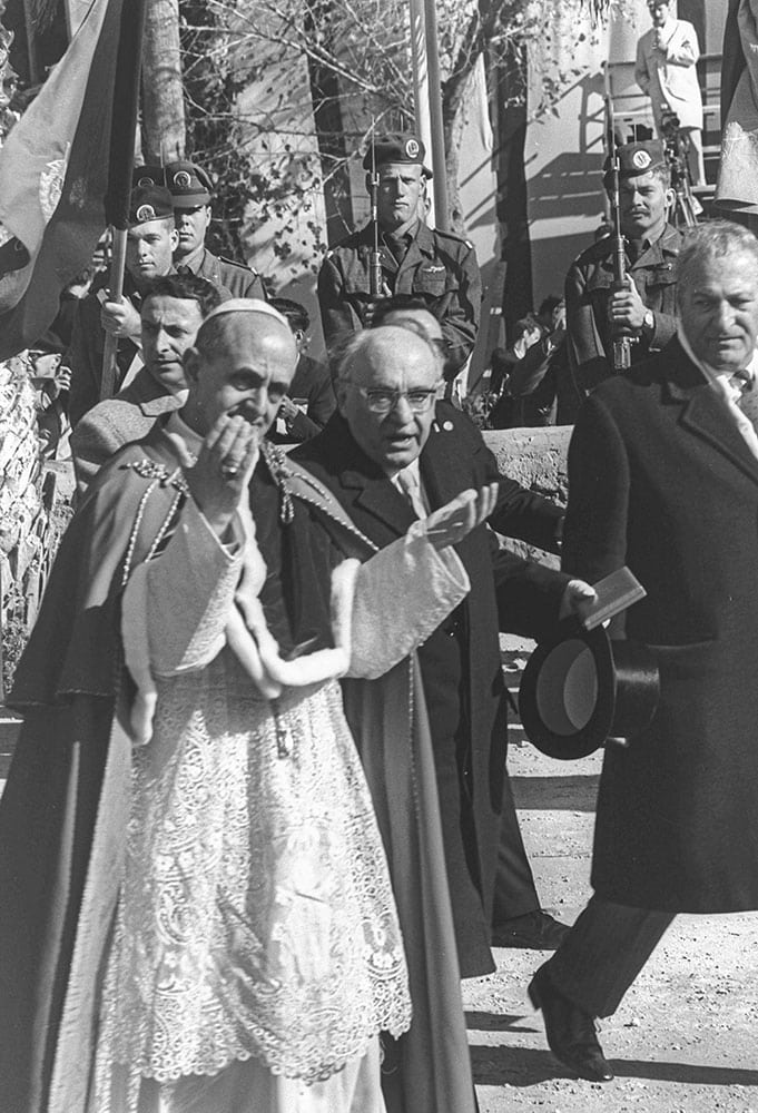
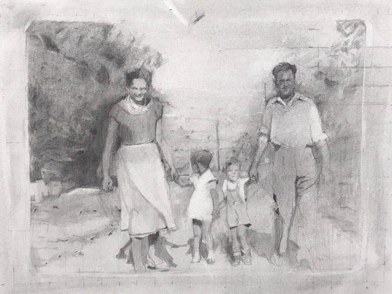
Painting her mother’s Auschwitz tattooed identification number turned artist Rachel Nemesh’s work into a voyage of self-acceptance as a Second-Generation Holocaust survivor and an emotional deepening of relations between mother and daughter. The results of this voyage can be seen in the exhibition As One, at the Israeli Art Gallery in the Memorial Center in Kiryat Tivon
Assaf Kugler
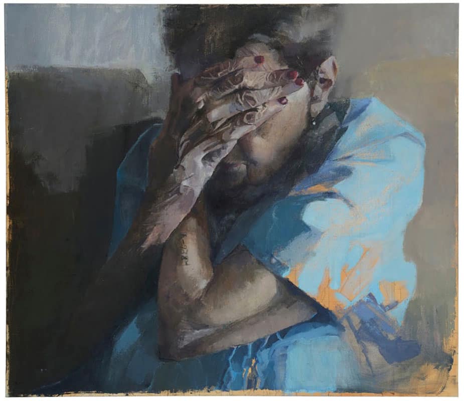
Rachel Nemesh’s website contains all the usual categories: About; Pictures – with pictures of her work; Jewelry – displaying the results of years of her work before she became a painter; Contact us; and the Testimony of Katia Nemesh. This last category exhibits the photographed testimony with the photos that were transformed into drawings of Nemesh’s mother, Katia, a Holocaust survivor, recounting her experiences during the Holocaust. This surprising twining of professional site and personal family history, of testimony and memory, loss and regeneration, creativity, and mother and daughter relationship embedded in the website, come to their fulfillment in the exhibition “As One” recently opened in the Kiryat Tivon Israeli Art Gallery. The tattooed Auschwitz identification number on her mother’s hand appears again and again in the mother and daughter portraits.
I belong to the second generation of Holocaust survivors, and this defines me and has defined me for my entire life. It characterizes my behavior, my relations with others, with my mother, with my children—even my relation to art.
Rachel Nemesh was born to Katia and Dov, in Kiryat Tivon, a small town overlooking the Jezreel Valley. “I grew up on “the Hungarian Street,” where many of the olim from Transylvania and Hungary had settled. After finishing high school, I studied photography and took art classes at the Avni Institute of Art and Design in Tel Aviv, in plastic arts. Thirty years ago, I abandoned the field of plastic arts and opened a jewelry studio.
Eight years ago, Nemesh closed her studio and began to study painting with Eli Shamir. “From that day, I knew that I had to dedicate my life to painting.” Five years ago, she decided to paint a portrait of her mother. The painting would be the beginning of the current exhibition with profound realism in oil paintings portraying art that ties the two issues of Second-Generation Holocaust survivors, and the feminist look of the mother-daughter relationship.
The idea of turning the paintings into an exhibition about her mother was born after a visit by curator Michal Shachnai Ya’akobi. Shachnai was so impressed by the big oil paintings and immediately asked when a presentation could be ready.
The exhibition opened four years later, on March 5, 2020, and after just a week closed because of the COVID-19 outbreak. Nemesh’s mother, the central object of the exhibition, was locked down in her room in the old age home in Kiryat Tivon.
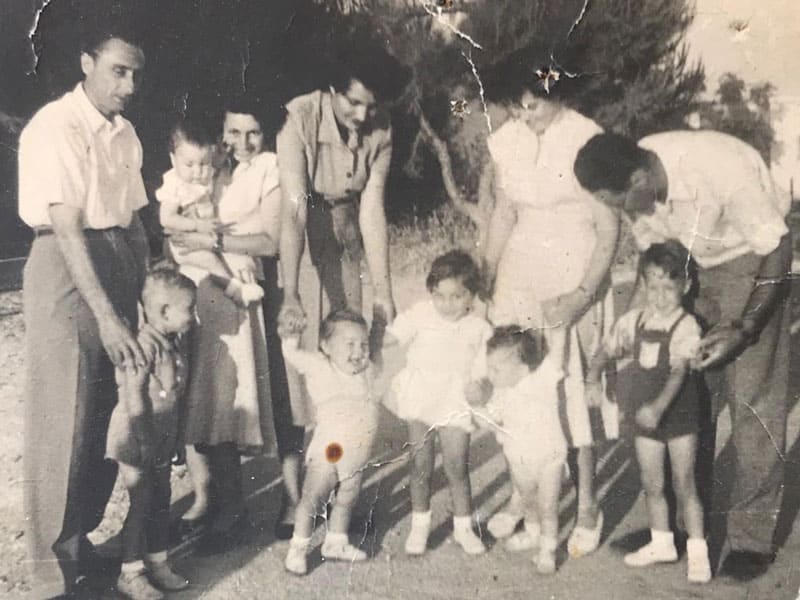
Katia Nemesh was born in Dej, (today in Romania). Her very religious parents owned a large textile shop. Most of the family, except Katia and one uncle, died in Auschwitz. She was released after the Death March from Bergen-Belsen, a very sick Musselman on the verge of death, and wandered about the streets begging for alms. Six months later, after recovering slightly, she decided to return to her hometown, Dej. There were no acquaintances left. The ransacked house of her well off family was full of holes and pits dug by the townsfolk looking for buried treasures. After meeting Dov, Rachel’s father, the two decided to make Aliyah. Their ship was caught by the British, and they landed in the Cyprus detention camps. Following the creation of the State of Israel, they settled with other olim from Transylvania in Kiryat Tivon.
In her youth, Katia had studied languages with a private teacher. She had been accepted for medical studies in the university, but the war put a stop to all that. In the camps in Cyprus, she began to study languages, and after making Aliyah finished her master’s degree in English and additional studies at Oxford University, England. Back in Kiryat Tivon, she became the town’s legendary English teacher.
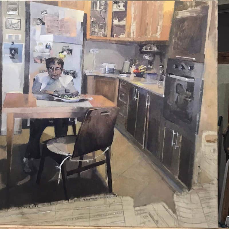
“Through her room that appears in the paintings, we can learn about her,” says Nemesh. “The utensils, the Hungarian embroidered runners, the neatly organized furniture, the portrait of a rabbi hanging on the wall, the books she loves, and the dictionaries attesting to her love of languages. She is very well educated and loves to read. The place where a person lives, his room and surroundings, reveal much about his personality.”
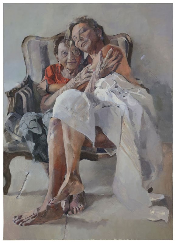
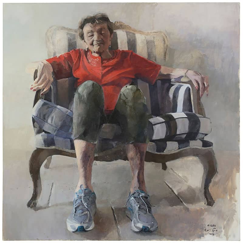
The exhibition shows two different characteristics of Nemesh’s mother. One part of the display shows the burden of old age on a woman secluded in her room, the other part exhibits large paintings that have an almost majestic feel, with the commanding figure of the mother looking down at the viewer. “For me, she is larger than life; she is a heroine with a strong will to survive, and at the same time, a small woman in an old age home. It is the story of each one of us – in the end, we are alone.”
When I started to talk about this with others, I opened up, created a place for memories, a place to embed the stories of our parents, of my mother. Slowly I noticed that I began to remember things she told me
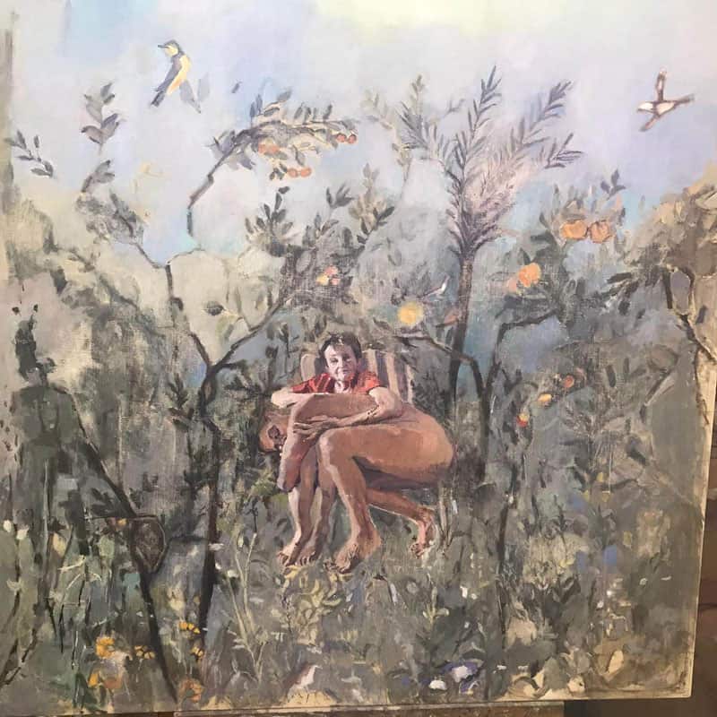
In many of the paintings, the tattooed number appears in its actual place on Katia’s hand. However, in some of the pictures, it appears on Rachel’s body, or on an eagle, hovering over her mother, as if it is the wandering symbol of the story that they both share.
“I belong to the second generation of Holocaust survivors, and this defines me and has defined me for my entire life. It characterizes my behavior, my relations with others, with my mother, with my children—even my relation to art. I have never documented anything, never made an effort to finish things – until I realized that this was a kind of survival technique; We always have to move on, to continue on our journey. Because we are constantly on the move, keeping things, memories, relations, is a kind of luxury.”
Creating the exhibition allowed Nemesh to feel more comfortable with herself. She even joined a support group of second-generation survivors – something that she had never wanted to do before.
“When I started to talk about this with others, I opened up, created a place for memories, a place to embed the stories of our parents, of my mother. Slowly I noticed that I began to remember things she told me. Where she was during the war, what she did. Small details. My mother also noticed that I suddenly began to remember.
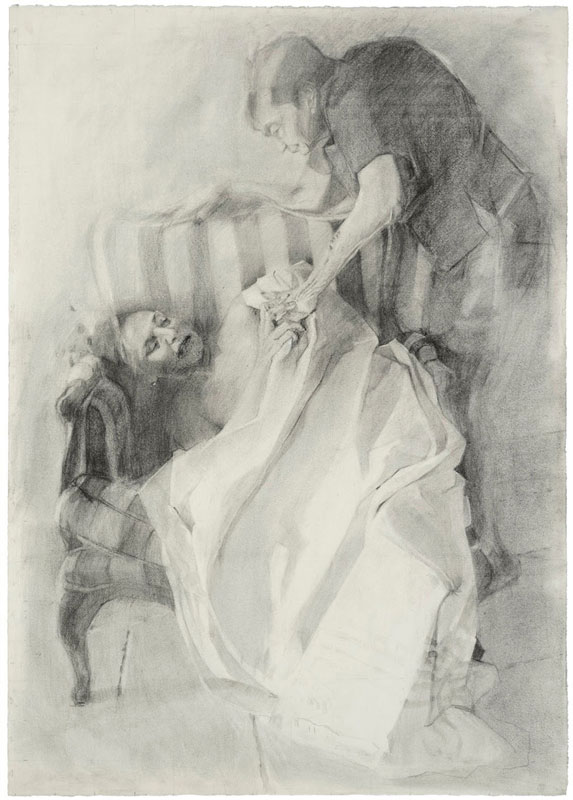
The paintings opened an opportunity for intimate work with the mother, even nude photographs, as a base for a portrait.
“The nude photos were taken by my husband Sharon, on his cellphone. I sat my mother down on our striped living room striped sofa, but nothing was staged. Going over the photos later, I could recognize the history of art, famous scenes such as La Pieta, or the resurrection. During the session, I felt something intimate that was not there before, that I never had with her. Something real. I realized that all my mother ever wanted was another hug from her mother, whom she had last seen in the line at Auschwitz.”
The meeting of Katia with her exhibition images was not comfortable. “It seemed as if she had to come out of hiding. But, at the opening event, she was honored and respected, and this made her feel good.”
The exhibition has now reopened at the Israeli Art Gallery, in Kiryat Tivon.
Sunday, Tuesday, 09.00-12.00
Thursdays between 10.00-18.00
Tel. 04-9835506.
As One, Rachel Nemesh.
Curator Michal Shachnai Ya’akobi.
Israeli Art Gallery, Kiryat Tivon
My English Teacher
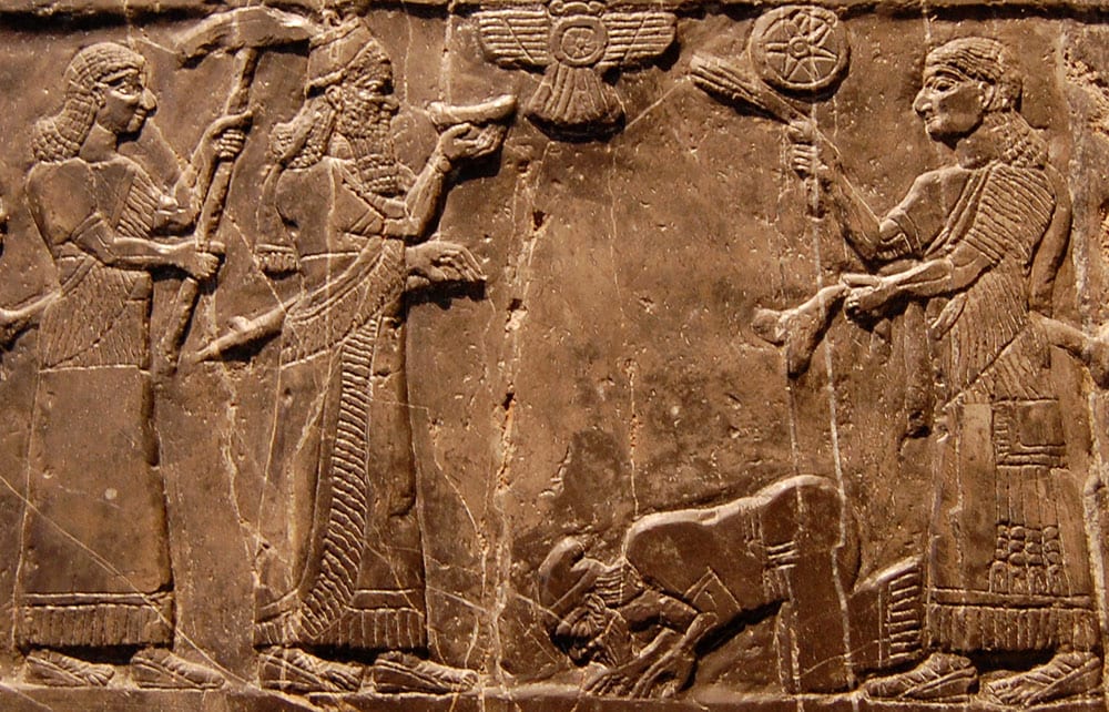
The old photo of the three women and a man, sitting together in Kiryat Tivon, was taken during the years of austerity in the 1950s. Katia, Koti to her Hungarian friends, is on the right of my mother, Hanna Kohl, and Lutsi Diamenstein is to her left. The man on the far right is my late father, Emil Kohl.
Avgar Admati, a childhood friend of mine, describes how she loved Katia Nemesh, our English teacher, and how, at the same time, she was afraid of her. “She had a kind of respectful quiet that awed us. A powerful gaze and voice that motivated us to study. Katia, like my mother, loved languages – European languages that could take them to another place, away and over the sea.
They had gone through a lot, something that we will never be able to imagine. But, Katia, like my mother, needed to instill in us – the young generation growing up in the new country, a love for the things that they had left behind – far away from this harsh and dry land. They wanted to open for us that window on culture, art, and literature of a world that for them was gone forever.
Dita Kohl
Embroidered Life
From the orchards of Hadera to Judaica in Naharia: artist Adina Gatt celebrates her eightieth birthday in these unusual times
Arbel Weinberg, Photos courtesy of Adina Gatt
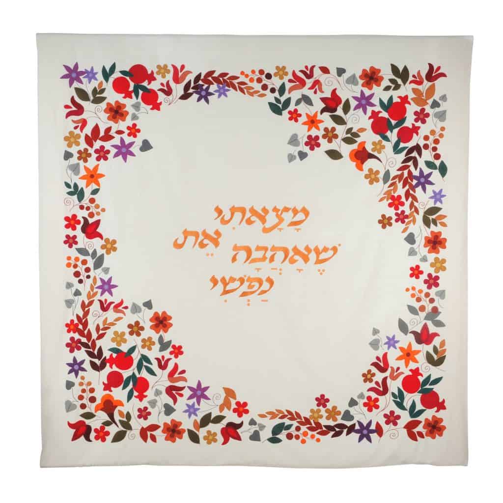
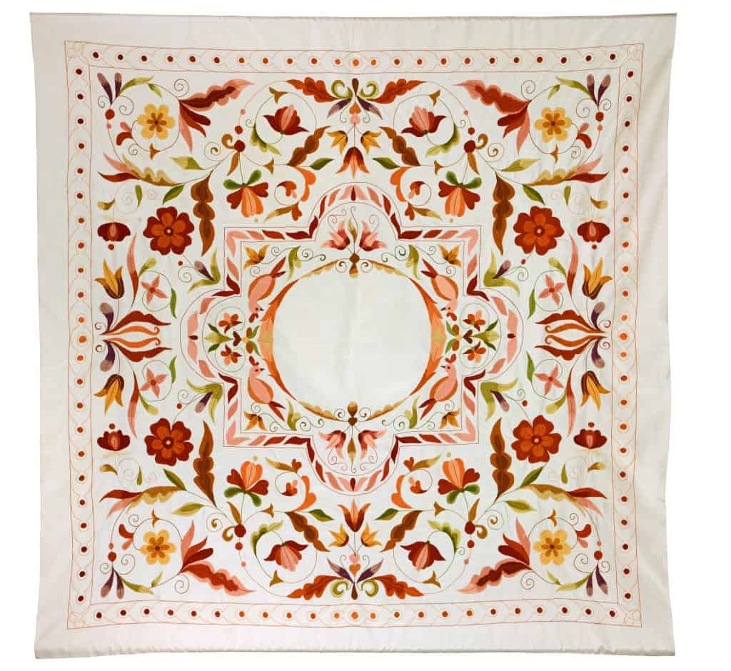
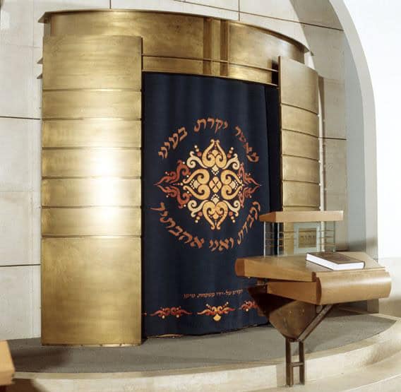
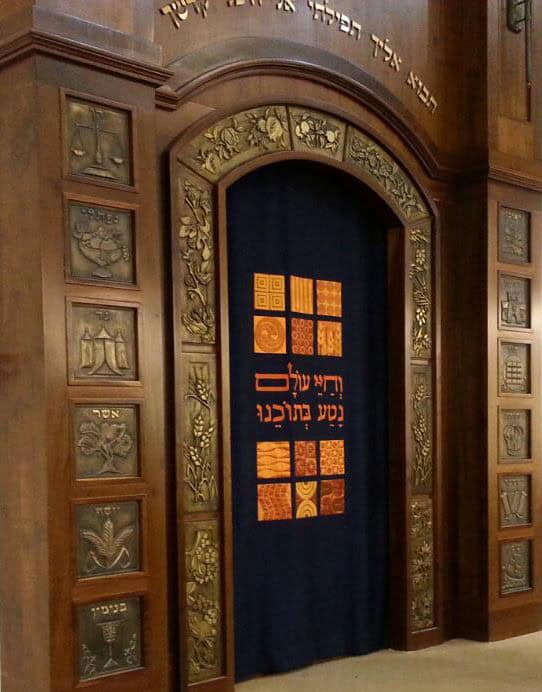
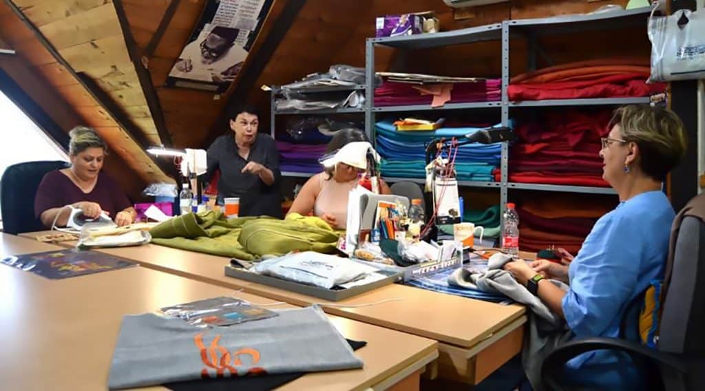
You may have come across some of Adina Gatt’s unique work in your everyday Jewish life; at the “Young Israel” synagogue in century city, Los Angeles; in the “Adat Israel” synagogue in D.C., in the “Yamin Moshe” temple in Jerusalem, or the “Hovevei Tzion” synagogue, in Chicago. Perhaps you were married under one of her exquisite chuppas or prayed with an embroidered tallit. Now, nearing eighty, Adina Gatt decided to wrap up her life’s work, and close the Ephod Art Embroidery studio in Naharia, Israel.
Saying goodby to thirty-eight years of a labor of love is not easy. The current COVID-19 crisis makes it even harder. But in the Ephod studio in Naharia, it seems that Gatt is more concerned with finding the right color combination for a commissioned Torah mantle than pandemics.
“It started after my father, Abraham Replanski, passed away,” she tells us. “I was already in the textile art business with my partner, Yael Shilo, but we were not creating Judaica. My mother wanted to commemorate my father by donating a new parochet – the curtain that covers the Torah Ark, to his synagogue. She was planning on ordering one from Bnei Bark. I asked her to let me make it in his honor. He was a wonderful father, an entrepreneur, a bit naïve, but a man of great compassion. My mother was surprised but happy. We embroidered the verse “Sing the Lord a new song,” from the book of Psalms on the curtain. I felt as if I was giving birth to something new. Later, my mother told me that she had gone ahead and ordered the one from Bnei Brak. She wasn’t sure we would make it on time.”

An Israeli Tapestry
Gatt was born in September 1940, in a tiny house in Hadera –at the time a small farming town, surrounded by citrus orchards. She had two older brothers and one younger one. Her parents – Fania and Abraham, had made Aliya in the early 1930s. The Replansky home was soaked with tradition and religion, intertwined with Zionism and influenced by the landscapes of a new homeland and the many different people around them. Abraham’s father, who lived with the family, was a Slonim Hassid. Synagogue liturgy and biblical verse, along with the pioneering agricultural spirit, created a new multicolored Israel tapestry. When she was almost 13, Gatt was sent to study at the Nahalal Agricultural School. At the age of 18, she joined a new semi-military Nahal agricultural settlement, and from there to Kibbutz Revivim in the Negev. It was a pioneering lifestyle, far from being religious or artistic. But the seeds sown in the fertile groves of Hadera bloomed in Revivim. “When you entered my home in the kibbutz, the first thing you saw was a portrait of Ben Gurion,” Gatt tells us. “His words, ‘Golden youth go to the Negev,’ were for us the eleventh commandment.”
Adina married Alon Gatt (Weinberg) and had a boy and a girl – Carmel And Sharon – and then said goodby to the Kibbutz. “When Carmel was born, I put him in the Kibbutz children’s home. That was the norm. For me, it was a terrible year. After Sharon, I knew I could not do it again.” So the young family left the Negev and settled in Naharia, in Western Galilee, a peaceful resort town on the Mediterranean, not too far from the Lebanese border. “My father had worked in construction in the area and was familiar with the town. He bought a plot of land in one of the outlying neighborhoods, surrounded by agricultural fields and open spaces. Buying real estate was very cheap back then.”
Her two other children, Yarden and Hadar, were born in Naharia, and that is where she met the artist Yael Shilo, who introduced her to the world of textile art. “I used to host art exhibitions at our home,” she muses. “Naharia had no art gallery, and I brought artists like Inus, Nahum Guttman, Ester Peretz Arad, Mario Doretti, and others to exhibit in our house. Yael Shilo came to one of the exhibitions and asked me if I would arrange an exhibition for her. I saw her work, loved it, and we joined forces.” They worked together for two years before they created their first parochet. During those two years, Gatt and Alon parted ways. Shilo created intricate wall hangings, and the two branched out to other fields. “We created embroidered fashion; vests, shirts, and espadrilles. But the way that the first parochet was received made us concentrate our efforts on Judaica. For me, it was a calling.”
A new Song
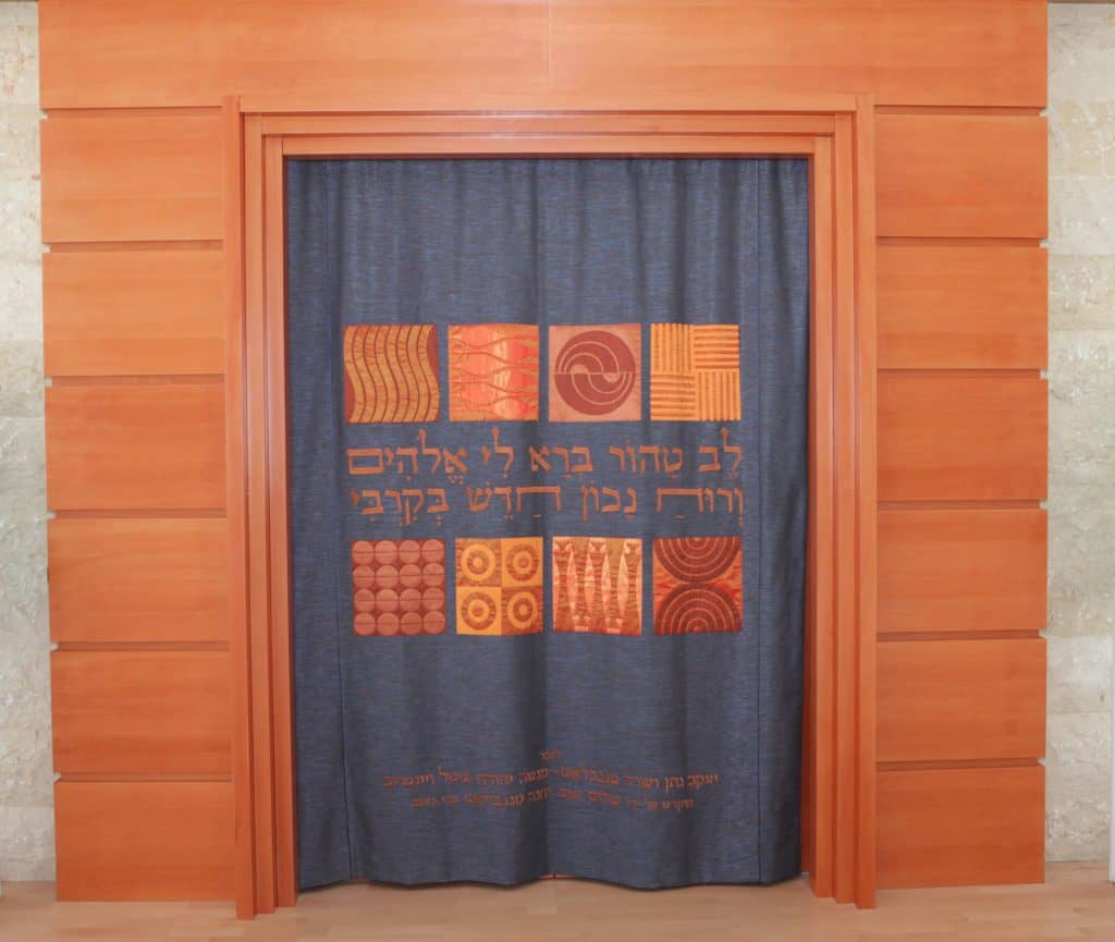
Ceremonial art was one of the first forms of art in Judaism. The bible dedicates seven chapters to the divine manual on how to build the tabernacle; structures, materials, tools, decorations. God even handpicked the artist to make it; “Then the Lord said to Moses, see, I have chosen Bezalel, son of Uri, the son of Hur, of the tribe of Judah. I have filled him with the Spirit of God, with wisdom, with understanding, with knowledge and with all kinds of skills to make artistic designs in gold, silver, and bronze, to cut and set stones, to work in wood, and to engage in all kinds of crafts” (Exodus 31). In the early days of Jewish resettlement in the land of Israel, the founding artists of the Bezalel Art Academy in Jerusalem immersed themselves in traditional Jewish art, adapting it to represent modern art forms. “But,” says Gatt, “When we founded our textile studio, Ephod, textile Judaica was not part of this new modern art movement. The novelty represented by metal, wood, and stone was not applied to textiles. Most of the textile artifacts were clichés, blue velvets, gold lions, tablets of the law, and a few biblical verses that had been used for decades. For me, the connection to Judaism was personal, a place where each person can find the one verse that has a special personal meaning. As a Judaica entrepreneur, my own special biblical verse was the instructions given in Exodus 28:15, for making the high Priest’s breastpiece: “Fashion a breastpiece for making decisions – the work of skilled hands. Make it like the Ephod: of gold, and blue, purple and scarlet yarn, and of finely twisted linen.”
Word of the unique Jewish art being created in the studio in Naharia spread to Jewish communities around the world. Soon, Gatt found herself flying to Canada and the United States, sending art from the studio to Vienna and Australia, Sao Paulo, and more. “The world is small, the Jewish world – even smaller. One client led to another, each congregation to a new community.
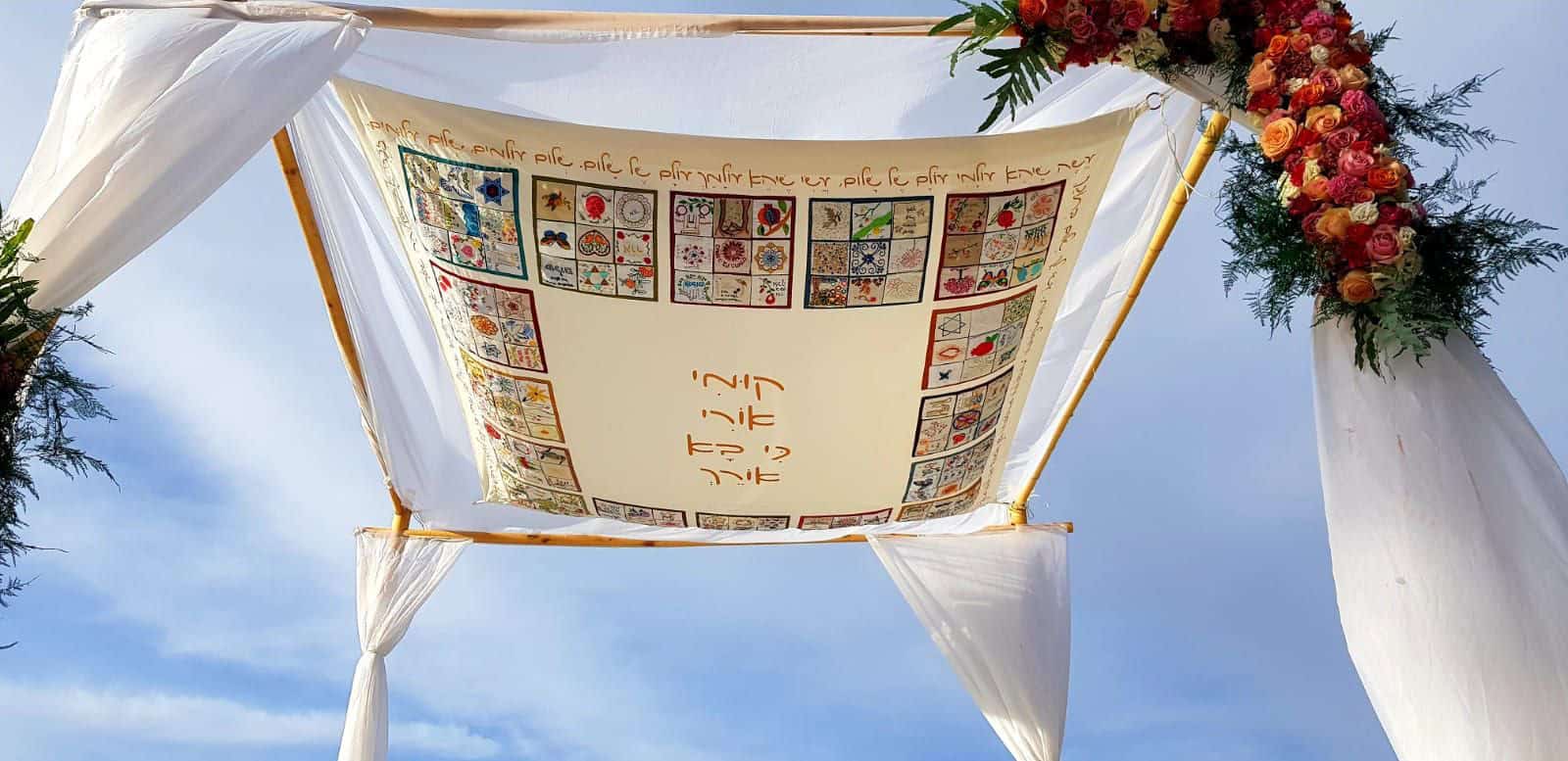
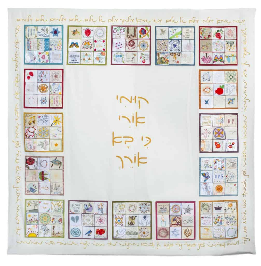
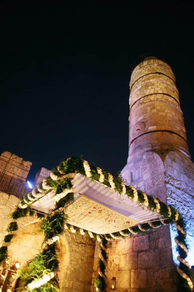
When Shilo left Ephod, Gatt moved the studio to her home, but it remained a hive of activity with women from around Israel taking part in the work; stitching, embroidering, ironing, and drawing. “It is very emotional creating these unique pieces, each one dedicated to a single person. To formulate the design, I search the bible to find the exact fitting verse.” One such piece, a chuppah, created not long ago, was made in honor of Ori Ansbacher, a 19-year-old girl who was murdered in Jerusalem. The brutality of the murder and the radiant personality of Ori resonated throughout the country. “Rabbi Bat-Sheva Sadan called for women around the world to embroider a square in Ori’s memory. We received around 5,000 embroidered squares, in a myriad of materials and colors, each one telling a unique story. We chose 144 of the squares and sewed them together to create a beautiful huppah embroidered with a verse from the book of Isiah: ‘Arise and shine (Ori), your light has come,’ with a poem Ori wrote embroidered on the rim.”
Ephod’s creations are an integral part of many family and community events, sad and joyous. “A huppah I made for a certain family, a long time ago, has already seen three generations of children married under it. For each wedding, the names of the newlyweds are added on the fringes.”
As she approaches eighty, Gatt is planning to close the studio. However, her work is here to stay with a new song every day.

White and Blue Beauties
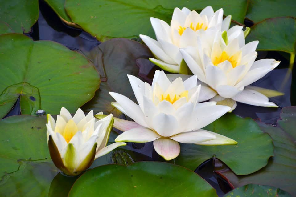
Waterlilies blooming in pools and other sources of sweet water is one of the coolest and most beautiful summer sights, one that can be seen at decorative artificial pools throughout Israel today. Most of these flowers, however, are relatively new arrivals. The two waterlilies indigenous to the land of Israel – the white waterlily (nymphaea lavana in Hebrew and Nymphaea alba in Latin) and the blue waterlily (nymphaea tehola in Hebrew and Nymphaea caerulea in Latin) – only grow in a few places and are in danger of extinction.
The two waterlilies indigenous to the land of Israel – the white waterlily (nymphaea lavana in Hebrew and Nymphaea alba in Latin) and the blue waterlily (nymphaea tehola in Hebrew and Nymphaea caerulea in Latin) – only grow in a few places and are in danger of extinction. The blue waterlily can be seen in the nature reserves at En Afek and by the sources of the Yarkon River, while its white sister grows in the Hula Nature Reserve. They also are part of the collection at the botanical gardens at the Hebrew University of Jerusalem and Tel Aviv University.
Waterlily is the common name used to refer to the spectacular flowers in the nymphaea genus, which includes 46 different species. The name nymphaea was inspired by the nymphs of Greek mythology: the beautiful, elusive creatures that lived among the trees and springs. In addition to its association with the divine, the waterlily was used for healing, decoration, and dye in the ancient world. Images of it appear in ancient decorations and mosaics.
The waterlily attaches to the floor of a pool or fresh water source that usually is not more than 1.5 meters deep. It grows upward, sending out branches with broad leaves that float on the surface of the water alongside beautiful flowers.
Many species from this stunning genus have been cultivated and have become popular adornments for artificial pools and fountains in gardens in cities throughout Israel, such as the pool on the eastern edge of Rabin Square in Tel Aviv. Yet the two species indigenous to Israel have basically disappeared from the Israeli landscape as coastal water sources and rivers succumb to pollution and development. Another difficulty is the coypu (nutria), which was brought to the Hula Valley in the 1950s in the hope of developing a fur industry. The effort to raise them commercially failed, but these large rodents succeeded to escape from the farms, adapt to their new surroundings, and multiply on their own. The coypu’s favorite foods include waterlily roots and branches and the growing coypu population quickly decimated the struggling waterlily population.
Luckily, some waterlilies had been collected for the botanical garden at Tel Aviv University and cultivated there. As part of efforts to develop nature reserves, waterlilies raised in the botanical garden were returned to the wild in the reserves at the Hula, En Afek, and source of the Yarkon River. Protective cages even were built around them to prevent coypus from devouring them.
One more indigenous plant worth mentioning is the yellow or brandy-bottle waterlily (hanofar hasahov in Hebrew and Nuphar lutea in Latin). It is not a member of the nymphaea genus, but of the closely related nuphar genus; both are part of the larger Nymphaeaceae family. Its yellow, ball-like flowers are much smaller than those of the nymphaea genus and like its cousins, the blue and white waterlily, it too is at risk of extinction due to the disappearance of natural water sources and pools. Both nymphaea and nuphar are competitive plants that do not let other plants flourish underneath their leaves. Yet they both also have great ecological significance: the shade that their leaves creates lowers the temperature in the water beneath them, enables the water to absorb more oxygen, and prevents different types of algae from growing. They also create a friendly habitat for a wealth of small fauna, which in turn attract larger animals and thus enrich the biological diversity of the aquatic environment. Owners of ornamental pools will be happy to know that these fauna include goldfish, which usually do not succeed to survive and reproduce in exposed pools, but often thrive under the canopy that waterlily leaves form.
The Grand Finale
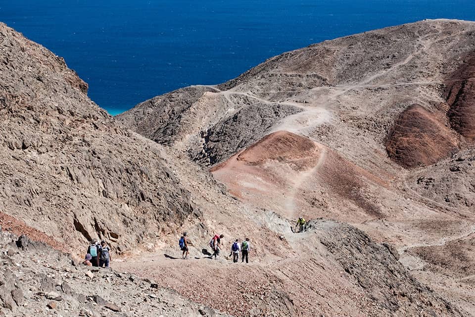
There are many reasons to hike the Israel Trail from north to south. The most convincing may be the dramatic experience of concluding the hike with the segment of the trail that runs through the Nahal Netafim Riverbed and the Nahal Gishron Riverbed. Below is a two-day hike through this segment, with a few changes and additions that I hope even purists will appreciate
For those not hiking the entire Israel Trail at once and camping out alongside it, the first day of this two-day hike starts by traveling from Eilat to the Nahal Netafim Riverbed. A dirt road with black trail markings that is navigable for cars and buses leads toward the starting point. Drive along this road until the campsite at the point where the black trail meets the green trail that ascends Nahal Netafim. Ascend the green route until the large parking sign. Vehicles with front-wheel drive can continue for another 300 meters or so.
The hike itself begins here, where the riverbed starts carving into the black granite. Some lovely examples of the toothbrush tree (Salvadora persica in Latin and salvadora parsit in Hebrew) grow in the riverbed. Further along is a large concentration of fig capers (Capparis inermis Forssk or Capparis sinaica in Latin and zalaf sehusi in Hebrew) that managed to survive the floods that sweep down the riverbed from time to time. (Please note that this riverbed should not be entered when there is a flood warning.) The green trail advances along the riverbed, which becomes a narrow canyon flanked by upright walls. Metal handles were installed at several tricky spots to make them easier for hikers. After about an hour of walking in the riverbed, the green trail meets the Israel Trail, which descends into the riverbed via a broad, steep channel (that has both Israel Trail and black trail markings). The Israel Trail joins the green trail on the bank of Nahal Netafim at a point where the riverbed is still a canyon but is broadening. The trail advances toward the foot of a steep slope on the northern bank. The large acacia tree at the bottom of the slope is a great place to rest, refuel, and contemplate the next part of the hike.
One option is to continue from here by following the black-marked trail up the boulder-dotted riverbed. The black trail later exits the canyon via ladders and reconnects to the Israel Trail. The other option is to follow the Israel Trail, which ascends the bank in a swift, dramatic climb to a lookout point that offers an impressive view of the Eilat mountains. About a kilometer after the viewpoint, the trails reconnect and then turns sharply to enter Nahal Netafim again. Here the riverbed carved into gleaming sandstone/limestone and its floor is dotted with rocks of stunning shapes that collapsed into it in the process. After about two kilometers, the trail reaches Ein Netafim, a tiny spring emanating at the foot of an impressive waterfall. Its water drips into a man-made trough. Its Arabic name is Ein al-Katar, which means the spring of drops or the dripping spring. Its water was first harnessed for human use during the British Mandate period when the trough was built. The trough has been destroyed more than a few times since then. Guides from the Eilat field school rehabilitated it in the 1960s and Israel Nature and Parks Authority inspectors have done so several times as well. The riverbed is named after this tiny spring, which is the only constant water source in the mountains of Eilat and attracts herds of gazelles and rock hyraxes. About a decade ago, the water of the spring was fit for human consumption, but it has since become saline, though desert animals still consume it. A handsome concentration of southern maidenhair fern (sa’arot shulamit in Hebrew and Adiantum capillus-veneris in Latin) adorns the cliff above the spring.
The ascent from the bottom of the waterfall may be one of the best reasons to hike this segment of the Israel Trail: a narrow passage through a crevice in the rock with a few metal handles to help. Anyone carrying a large backpack will have to remove it since a hiker and a backpack cannot fit through this crevice together. The most challenging part is at the top, where hikers must maneuver nimbly over a large rock in the crevice to complete the ascent.
The Netafim campsite is above the waterfall. This is a great place for those who are hiking the entire trail at once to spend the night.
The route continues to ascend a dirt road leading from the campsite to Route 12, near the ascent to Mount Yo’ash. The Israel Trail continues on the other side of Route 12. Carefully cross the parking area south of the road to reach the sign declaring that the final segment of the Israel Trail begins there. This segment runs through the Nahal Gishron Riverbed.
The massive fence along the Israeli-Egyptian border was completed several years ago as was a road running alongside it. The route of the Israel Trail, particularly the segment that descends into Nahal Gishron, changed as a result. The new route is much more beautiful than the previous one, which ran directly along the riverbed.
Two hiking trails lead out of the campsite. The trail marked in black follows the route of Derab al-Haj, the pilgrims’ route to Mecca. Despite a few ancient leopard traps near that route, this hike chooses the second option: following the Israel Trail, which continues from here along with a route that has blue trail markings. This route bypasses Mount Yo’ash, proceeding along its dramatic hogbacks from the west, and then descends to a layer of shockingly red sandstone. The route continues at the same height as if the path were carved into the red stone. It is a short walk to the Gishron Ali viewpoint, which is located slightly above the trail on the black-marked trail mentioned earlier.
The Gishron Ali viewpoint offers one of the most dramatic views in the Eilat mountains. Deep below it is the Nahal Gishron Riverbed, with the border fence and the border road winding through the narrow, black canyon in an impressive example of engineering work. Beyond it, the Sinai and Gulf of Eilat can be seen.
There are two options for how to continue from the viewpoint, depending on how much time remains until sunset. If there are at least three more hours of daylight, continue along the new route of the Israel Trail that was marked after the border fence was completed. This route descends into the riverbed and includes several challenging descents along with metal ladders as well as descending the big waterfall in Nahal Gishron.
Shortly after the waterfall, the Israel Trail continues in one direction and a red-marked trail continues in a different direction. After a short walk, the red trail joins a green trail, ascends to the northwest, passes over a small shoulder, and reaches the upper Nahal Shelomo campsite, where the first day of this hike concludes.
The second option is shorter and more interesting. It involves descending along the black-marked trail that parts ways with the Israel Trail slightly before the ascent to the viewpoint. This path descends into the stunning sandstone expanses whose stripes of red and white resemble a hug layer cake. The path descends in a broad channel and makes its way toward Route 12. However, slightly before it seems to have reached the end, it instead reaches a waterfall and handsome hogbacks that actually are the southern edge of Mount Yo’ash. Hogbacks form on sharply inclined layers of rock. The angle creates expanses that are almost vertical so that the sediments along them peel away parts of layers in the form of triangles. Tomorrow’s route passes many hogbacks.
The path descends, with the help of a series of metal handles, along a layer of stone that is almost vertical. After this descent, the trail continues toward the big curve in Route 12. This is a good place to arrange to meet cars (there is a large parking lot next to the highway) to take tired hikers to a hotel in Eilat. Another option is to continue carefully alongside the highway for 1.5 kilometers to reach the upper Nahal Shelomo campsite and spend the night there.
Day Two – Dramatic End of Trail
The Israel Trail’s final segment, from the upper Nahal Shelomo campsite to Eilat, is without a doubt one of its most beautiful. There are two options for the start of the hike. The longer option is to return from the campsite along the green path to Zafra Pass. Then continue through the water conveyor/waterworks (once hikers had to crawl to get through the narrow crevice in the rock) to the Israel Trail, which descends into Nahal Gishron. The route includes climbing a three-meter waterfall and the steep Gishron ascent.
However, the steep climb is not mandatory. Another option is to descend from the campsite on the bank of Nahal Shelomo and then to turn onto the green-marked trail in the Nahal Yehoshafat Riverbed and follow it to the blue-marked trail, which ascends to the top of the Gishron ascent.
Another option is to drive down the bank of Nahal Shelomo on the red-marked trail to the Nahal Rehav’am Riverbed and then to drive along the blue-marked trail to the roadblock before the road paved alongside the border. Part from the car and driver there and begin the hike on foot. Those who did not sleep at the campsite or who simply wish to hike only this part can reach it by car on the road ascending from Eilat through Nahal Shelomo to the big campsite at Nahal Shelomo. The road passes a camel ranch and then can be followed to the campsite and beyond it to the turnoff into Nahal Rehav’am and the roadblock.
All of the options mentioned above lead to this path, which climbs an ascent dotted with large bulblike limestone masses to the top of the Gishron ascent. This is a great spot to gaze at Nahal Gishron in all its glory as it winds down the slope below as well as the Sinai landscape. After taking in the view, walk south on the Israel Trail along a handsome spur between Nahal Rehav’am and the cliffs that descend into Nahal Gishron, the Gishron cliffs. However, before continuing forward toward the end of the Israel Trail, take a slight detour to Hill 342. An unmarked path leads to its summit. The ascent is a bit steep but worth the effort. The summit offers a panoramic view of the entire area, mainly the Rehav’am Valley with Mount Rehav’am in the middle of it, to Mount Shelomo and its brothers, which are named after the kings of Judea. Descend from the hill and continue following the Israel Trail and the black-marked trail southward. This route leads past a huge bulblike flint mass that was split in two. The quartz masses, which the bulb formed around, glitter from what was its interior. A few meters after that, the trail reaches the security road along the border. The Israel Trail continues to the other side of the road. However, before following it, those who started on the shorter route can take the time to walk along the black trail that also starts on the other side of the road. This path ascends the Gishron cliffs to an amazing lookout point over the Sinai. The path no longer continues beyond there, so hikers must retrace their steps back to the beginning by the road, but the view is worth this slight deviation from the main route.
Return to the Israel Trail, which is marked in red at this point. The path descends into the valley and starts to climb Nahal Gishron’s northern bank above a huge cliff whose layers came to rest at 70-80 degree angles some 100 meters above the riverbed’s floor. This series of hogbacks is part of the sandstone ridge separating Nahal Gishron from Nahal Zefahot. The hogbacks, which look like they were designed by an artist, adorn the cliff, with a wall that is almost vertical descending from the path above it that leads into the riverbed.
The climb ends at a spot that offers a view of the Eilat mountains. The trail then continues toward Mount Zefahot. The short segment of the Israel Trail that remains has been nicknamed the Knife Ridge Trail because it runs along the crowns of the hogbacks – it is a narrow path with deep and steep abysses on either side. The crowns of the hogbacks offer a view of the Mountains of Edom, the Gulf of Eilat, the Jordanian city of Aqaba, and the mountains in Sinai.
Once, before the border was defined and fenced, the trail descended to Nahal Gishron and ascended in a small channel dotted with bulblike limestone masses. The upper edge of the ascent as well as dozens of the round masses still can be seen today to the right of the trail.
The path now continues toward the final challenge on the Israel Trail. After an easy walk in the wide, flat Nahal Zefahot, the black trail that the Israel Trail had been following meets a green-marked trail that began at the campsite in the lower part of Nahal Shelomo. The Israel Trail continues with the green trail, which now makes a sharp right and climbs through a schist channel to reach Mount Zefahot’s summit. It is a steep climb and towards the end there is another climb before the summit, but from the top, there suddenly is a view of Gulf of Eilat and the city of Eilat, which is directly below, as well as of Aqaba on the other side of the gulf. Four countries actually can be seen from the summit: Israel below, Jordan beyond the gulf and Saudi Arabia to its south, and Egypt on the other side. To the south, the coral formations can be seen opposite the shores of Sinai.
Several trails descend from Mount Zefahot to the beach in the Gulf of Eilat. The Israel Trail markings lead along a route of natural steps that descends toward the Eilat field school. After the first section of the descent, a black-marked trail leads southward. This is a beautiful, steep, difficult route toward the diving village on the Eilat beach. Another trail, with blue markings, descends along an easier route to the traffic circle and gas station on the main road. The trail is easier, but the conclusion, in an area with construction waste and industrial ruins, is not the right way to conclude a journey along the Israel Trail. The other trail that descends from the mountain is marked in red and turns southward. This handsome stretch of trail actually was the original conclusion of the Israel Trail. Today, however, it is forbidden to hike along this trail due to its proximity to the border fence.
The Israel Trail thus ends at the fence of the Eilat field school. A large stone on which the trail colors were painted indicates its end. The sign marking the end of the trail is a few hundred meters further on inside the field school’s grounds. It is a pity that the sign was not placed at the ending point or that a handsome new sign was not placed there to symbolize for hikers that they have completed the 940-kilometer hike from the Dan to Eilat.

The Battle for Acre
The Crusader siege of Acre has many conflicting accounts, Christian narratives as well as Muslim descriptions. Recently scholars are trying to create a unified account of the 653-day battle – the longest battle of the Middle Ages
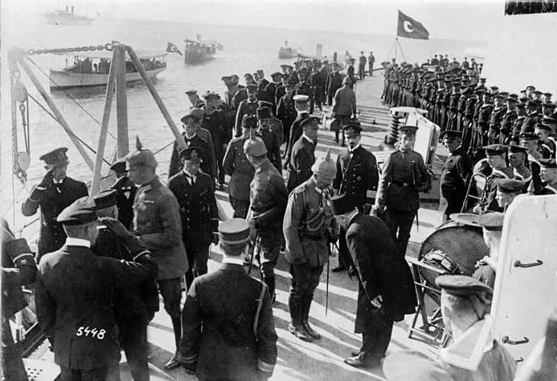
As the sun rose over the mountains of Galilee and lit up the flat plain along the Mediterranean Sea, the army of Saladin, Sultan of Egypt and Syria, appeared before the walls of Acre. It was July 9, 1187; five days after the sultan had decimated the Crusader army at the Horns of Hattin. One thousand knights had died in the battle; many more were taken prisoner, including the Crusader King, Guy de Lusignan. The Holy Cross, brought from Jerusalem to instill courage in the Knights, had also fallen into the hands of the Muslims. Following his victory, nothing could stop Saladin from marching on Jerusalem, the capital of the Crusader Kingdom. Nevertheless, Saladin preferred to deal first with the Crusader coastal cities, to prevent the landing of Christian reinforcements from Europe.
The Crusader governor of Acre, who had managed to escape the carnage at the Horns of Hattin, hurriedly surrendered the city to the Muslims. Some of the nobles in Acre protested the decision and threatened to set fire to the city and commit suicide. However, once Saladin promised that the Christian population of Acre could peacefully leave the city and take their possessions with them, the nobles conceded. The Sultan appointed his cousin, Afdal Ali, as governor of Acre, and marched his army northward to the Crusader cities along the coast of Lebanon. Sidon fell on July 29, Beirut eight days later. Then he turned to the south and took Ashkelon. On October 9, 1187, the Sultan entered Jerusalem. The majority of the Christian population fled; those remaining were slaughtered. Jerusalem would remain in Muslim hands for the next 730 years.
The only Crusader city that held out was Tyre where many of the survivors of the Horns of Hattin had taken refuge. Ten days after the Crusader debacle the Marquis Conrad of Montferrat arrived at Tyre. He had left Constantinople a few days before the battle at the Horns of Hattin, to join his father in the Crusader camp. The battle was over before he managed to dock at Acre, and his father had fallen prisoner. Conrad made his way to Tyre and began to organize the city’s defense. He soon became the main Christian leader in the East.
Conrad saw himself as Guy de Lusignan’s rival for the title of King of Jerusalem. Guy had received the royal title due to his marriage to Sibylla, mother of the former king; Baldwin V. When Baldwin suddenly died, in 1186, at the age of nine, his mother, Sibylla, had chosen Guy as her spouse and by that made him King of Jerusalem. De Lusignan was Sibylla’s second husband. Her former husband, William of Montferrat, Conrad’s brother, had died in 1178. Conrad never forgave her for not taking him as her spouse.
The disaster at Hattin echoed around the Christian world, rekindling the waning spirit of the Crusades. Pope Urban III planned to declare a new Crusade to free the Holy City from the Muslims. However, his heart did not survive the awful news from the Holy Land. On October 20, 1187, he suddenly died. It fell to the new pope, Gregory VIII, to launch Christendom’s Third Crusade.
Three months after the pontifical announcement the only two leaders who could lead the crusade – Henry II of England and Phillip II of France, met in order to hear from the bishop of Tyre a firsthand account of how the Holy City had fallen. The horrific description moved the two royals and they declared on the spot that they would take up the cross. Henry created a special tax, “Saladin’s Tithe,” that raised the large sum of 12,000 pounds sterling, to support the crusade, paid mostly by the Jews of England. Two months later the German Emperor, Fredrick Barbarossa, announced that he too would join the crusade. However, while preparations were being made, Henry II died. The throne of England went to his third son, Richard, known as Richard the Lionhearted. On his coronation, Richard announced that England holds stay on its intention of going on the crusade.
As Europe got organized to save the Kingdom of Jerusalem, the kingdom’s nobles were busy squabbling among themselves. In the summer of 1188, Saladin added fuel to the local rivalry by releasing Guy de Lusignan from captivity. Saladin hoped that the struggle between Guy and Conrad for the leadership of the kingdom would weaken the resolve of the remaining knights and nobles.
On his release, Guy gave Saladin his word that he would not take up arms against the Muslims, a promise that no one expected him to keep. Guy made his way to Tripoli (Lebanon) where many of the nobles of his defunct kingdom had taken refuge.
Meanwhile, Conrad had managed to fortify Tyre and repel an attack by Saladin in November 1188. After a ten-month siege, the sultan gave up and retreated to regroup in the mountains.
In Tripoli Guy and Sibylla raised an army of 500 knights and 7,000-foot soldiers, most of them survivors of Hattin. Leaving Tripoli, this makeshift army marched down the coast, to Tyre. Conrad refused to let them into the city, and Guy decided to continue south, to the next coastal city, Acre.
News of this new Crusader army quickly reached Saladin, bivouacked in Lebanon, at the massive fortress of Beaufort overlooking the Litani River. The sultan’s commanders advised immediate attack. The sultan hesitated, thinking that the small army was actually a trap.
A four-day march brought Guy across the Ladder of Tyre, the steep mountain range between Lebanon and the Land of Israel, to the fertile valley of the Betzet River. The next day, August 27, 1189, Guy and Sibylla’s small Crusader force reached Tel Acre, the hill overlooking the city. Blocking access to the gates of the massive walls, they announced that Acre was now under siege. It was the beginning of the Crusader period’s longest siege.
Saladin still hesitated. Even though the Muslim garrison of Acre could have easily beaten off the handful of Crusaders on the hill, the Sultan decided to move his army to the coastal plain around Acre, and attack the Crusaders from the rear. On August 30, he took up positions on Tel Kisan, in the wide floodplain southeast of Acre, trapping the Crusaders between the garrison in the city and his forces on Tel Kisan.
The Crusaders managed to mount a few small sorties against the walls of Acre, but without siege engines, Guy had no chance of penetrating the massive fortifications. Meanwhile, the Muslims succeeded in opening a corridor through the Crusader lines and send reinforcements and supplies into the city.
Fortunately, for Guy de Lusignan and his small group of knights, two weeks after he took up positions opposite the walls of Acre, in the middle of September, the vanguard of the Third Crusade arrived; a fleet of 50 ships carrying 12,000 Flemish, German, and Breton troops. A few days before a small fleet of Danish and Welsh soldiers had arrived from Cornwall. At the end of September Conrad of Montferrat joined the siege, understanding that the opening gambit of the Third Crusader was going to be opposite the walls of Acre. Conrad arrived with a force of 20,000 soldiers and 1,000 knights. By the end of September, the Crusader army numbered more than two thousand knights and over 30,000 soldiers. A fleet of Christian ships blocked Acre from the sea and prevented any supplies from entering its harbor.
The Muslim forces inside the city were under the command of Emir Baha al-Din al-Asadi Karkush, one of Saladin’s most experienced commanders. The Muslim strategy was to organize simultaneous attacks on the Crusaders, from the direction of the city and the direction of Saladin’s troops on the plain. At the dawn of September 14, the Muslims launched their first attack, the first battle of the siege of Acre.
Saladin’s forces tried to reopen the corridor into the city and at the same time engage the entire Crusader army. The left side of the Muslim front advanced along the banks of the Na’aman River to the south of the city. The right flank advanced along the beach north of the city and in the center, Saladin’s best troops engaged the main Crusader army.
During the first day of the battle, the Muslims managed to reopen the narrow corridor to the city. On the second day, fresh Muslim troops widened the gap in the Crusader lines and set up a defensive perimeter along the corridor. Once the break in the Crusader front was established, Saladin sent supplies, food, and reinforcements into the city. The next day Saladin himself entered Acre and from the top of the walls looked out over the battlefield.
The Muslims tried to tempt the Crusaders to leave the safety of their batteries and launch an attack, but the Crusaders did not budge. Eventually, the Muslims managed to break through the batteries and reach the tents of the main Crusader camp. Only fierce hand-to-hand fighting managed to stop the attack.
Two weeks later, on October 4, the Crusaders were ready to counterattack. The battle began at 9 a.m. The Templar and Hospitaller knights charged into the lines of the Muslim soldiers. At a certain point, Taki al-Din, Saladin’s cousin, commanding the forces in the center, feigned a retreat to entice the Crusaders to advance further away from their defenses. Saladin, seeing the retreat from afar, thought that his center was collapsing and diverted troops in the direction of Taki al-Din. The Crusaders, noticing that Saladin had thinned out the troops in his area, charged in that direction. The Muslim force broke and retreated. At this point, when the knights could have won a decisive victory, they halted their advance to pillage the Muslim tents, losing the momentum of their attack.
Saladin regrouped his dispersed army and attacked the Crusaders busy pillaging the Muslim tents. The battle turned into a Crusader blood bath. The Crusaders, embroiled in the tents had no room to maneuver and fell one by one. The carnage stopped when Geoffrey de Lusignan, Guy’s brother, managed to put together a group of Knights and halt the Muslim attack.
Come autumn the European vessels began to leave. Sailing in the Mediterranean stopped during the winter, and new ships could only arrive in spring. On December 26 al-Adil, Saladin’s brother managed to enter Acre harbor with an Egyptian fleet from Alexandria. It was the last fleet to arrive before winter set in.
16 months of fighting had passed since Guy de Lusignan had first appeared before the walls of Acre. However, while most of Saladin’s troops returned home for the winter, the Crusaders had nowhere to go. They stayed in their trenches and tents, facing the cold, rain, and a growing shortage of food.
Enter the Kings
During the winter very little fighting took place, and Saladin, ill in bed, utilized the lull to regain his strength.
The Crusaders utilized the winter to build a new array of trenches and batteries and construct impressive siege machines, including three large wooden towers higher than the walls of Acre. The battle resumed at the end of March 1190. Conrad, who had spent the winter in Tyre, sent fresh troops and provisions, and Saladin regained his health and took command of his troops.
The fighting now concentrated on the defenders’ attempts to stop the advance of the Crusader towers toward the walls. By May 5, the Crusaders succeeded in positioning their towers, and the Acre garrison now concentrated their efforts on setting the towers on fire.
Meanwhile, Saladin received worrisome news on the advance of the army of the German Emperor Fredrick Barbarossa. The emperor had left Regensburg in southern Germany on May 11, 1189, with an army of 15,000 soldiers and hundreds of knights. The German army was the most disciplined and organized of any European army. The emperor planned to lead the bulk of the army overland to Acre, marching a disciplined 30 kilometers a day. Additional German units, sent by sea, had stopped over in Portugal to help the Christians fight the North African Moors. The maritime force wintered in Marseille and Sicily and arrived in Acre in June 1190.
Meanwhile, the main German army marched through the Balkans fighting all the way against Bulgarian brigands and Turkish marauders. At the beginning of June, the Germans captured Konya, in Anatolia. Then, while crossing a small river, Fredrick Barbarossa slipped from his horse and drowned. It was a serious blow. His son, Fredrick of Swabia, tried to take command but lacked the leadership qualities of his father. The army fell apart and became prey to ambushes and attacks. On June 21, 1190, the survivors of the grand army crawled into Christian Antioch, Syria. After two months of recovery, they continued to Tripoli where Conrad of Montferrat helped them get to Acre. Of the proud army that had set out 13 months ago, only 700 knights and several thousands of soldiers made it to Acre. The last blow occurred on January 20, 1191. Fredrick of Swabia fell ill and died. The German army as an organized fighting force ceased to exist.
In July 1190, Sibylla, Queen of Jerusalem, passed away. Her death undermined the legal status of Guy de Lusignan as king of Jerusalem. On October 24, Conrad married the new heir to the title, Sibylla’s half-sister, Isabella. The three archbishops in the Acre camp opposed the marriage. For starters, Conrad was already married, to two other women, one in Italy and the other in Constantinople. Isabella was also married – to Humphrey III of Toron, a member of one of the noble families of the Crusader kingdom. Humphrey and Isabella had married when Isabella was 11 years old. Following the death of Sibylla, Humphrey, who was present in the Crusader camp, did not try to claim his right to the throne, and Conrad took advantage of the situation. Shortly after Conrad announced his wedding plans, two of the three archbishops died. The road was now clear for the marriage to take place. Isabella had her marriage to Humphrey annulled and Conrad became the king of Jerusalem. No one mentioned his two other wives.
The wedding reception took place in the Crusader camp. As the festivities progressed, a group of drunken knights decided to hold a jousting tournament outside the camp’s perimeter. As the knights made their way back to the camp, they were attacked and killed.
As the second winter of the siege set in, Conrad and Isabella retired to Tyre promising to send supplies and reinforcements – which never arrived. The ships returned to Europe, Saladin sent his forces home, to rest – and only the Crusaders, shivering and hungry, remained for another winter in the camp opposite the besieged city. Life in the Crusader camp during the winter of 1191 was harsh. Food for the soldiers and fodder for the horses ran out, and many began to have doubts that they would ever manage to take Acre, not to mention Jerusalem.
During the winter, part of the walls of Acre collapsed. The Crusaders launched an attack through the breach in the walls, and the garrison, mostly new troops, barely managed to stop the Crusaders from entering the city.
In September 1190, the two strongest European monarchs set out for the Holy Land. Richard sailed from Marseille and Phillip from Genoa. A few days later the two royal fleets met in Sicily, where things began to get complicated.
The king of Sicily, William II, was married to Richard’s sister Joan. On Richard’s arrival, William II died and his heir, Tancred, refused to return Joan’s dowry. At the same time, Richard canceled his engagement to Alice, Phillips half-sister, in order to wed Berengeria the daughter of the King of Navarre. The event did not improve the relations between the two kings.
After Easter, the major forces of the Third Crusade finally began to arrive. Phillip with six ships of the royal French fleet arrived on April 20, 1191, soon to be joined by Conrad of Montferrat.
Phillip began immediately to reorganize the Crusader camp. The batteries and trenches were strengthened, new attack towers built, assault machines constructed, and fighting plans revised. On May 30, the Crusaders began to bombard the city and roll a “Welsh Cat” toward the “Accursed Tower”, the great tower at the northeastern corner of the walls. The Cat was a wooden tower with metal arms at its top that could tear out stones from the wall and dismantle it. Wet hides covered the towers to prevent the defenders on the walls to set them on fire. The Crusaders began to fill in the dry moat that surrounded the city while sappers dug under the walls in an attempt to topple them. The renewed activity raised morale in the Crusader camp.
The Muslim defenders hurled combustible firebombs at the towers and the attacking forces and sallied out from concealed posterns in the moat to thwart the attackers’ attempts to undermine the wall. The fighting continued around the clock until a portion of the wall collapsed and the Crusaders charged into the breach. For a short while, they managed to hold a bridgehead in the city. However, the Muslims counterattacked and the Crusaders retreated. That same night the Muslims shored up the wall.
Negotiations
After settling his sister’s dowry in Sicily, Richard set sail for the Holy Land. Three days out of Sicily the fleet ran into a storm and the ships dispersed. Several, including the one carrying Berengaria, took shelter in Cyprus. The Byzantine ruler of the island, Issac Commenus, on realizing the identity of the royal passenger, demanded a ransom for Berengaria’s release from the island. Richard was furious. Landing at Limassol on May 5, he conquered Cyprus, freed Berengaria, and wed her in the church in Famagusta. Leaving his new queen and her retinue in Cyprus, he continued to Acre.
Richard’s arrival in Acre, on June 8, 1191, rekindled the rivalry between Guy de Lusignan and Conrad of Montferrat. Guy, when he heard that Richard was in Cyprus, hurried to the island in order to get Richard’s support for his claim to the title of king of Jerusalem. Sibylla, Guy’s deceased wife, was Richard’s cousin and the Lusignan’s were vassals of the king of England. On his arrival, Richard announced that Guy was the legal heir to the title of King of Jerusalem. Conrad, enraged, left the Crusader camp and returned to Tyre.
Nine days after Richard’s arrival in Acre, Phillip called for a Crusader attack. Richard, claiming that the army was not ready, had the attack postponed. A few days later Phillip again demanded to launch an attack, again Richard refused. Nevertheless, Phillip decided to attack. The attack, beaten back by the Muslim defenders, was a dismal failure.
Due to the harsh living conditions in the camp, the two kings came down with a fever. While they were recovering new ships with seasoned knights and soldiers from Cyprus arrived. The bombardment of the walls and the constant firing of arrows and lances at the defenders continued now all through the day and night.
As the months dragged on the Acre garrison realized that the city’s fall was inevitable, and sent out feelers to negotiate Acre’s surrender. The initial Crusader demands were high. Richard wanted to continue fighting; Phillip demanded the return of the Holy Land. The negotiations created a rift between Richard and Phillip, and Saladin and his commanders in Acre.
On July 7, Saladin launched an attack on the Crusader camp. The attack failed and its purpose was unclear. That same night a powerful earthquake shook the Galilee. The Accursed Tower collapsed together with segments of the walls of the city. The defenders managed to patch up the damage, but it was clear that the game was over. 653 days had passed since the beginning of the siege and all sides were ready to bring it to an end.
On July 12, the Muslim leaders of Acre arrived at the Crusader camp to finalize the city’s capitulation. The Muslims agreed to deliver Acre to the Crusaders and return the Holy Cross captured at the Horns of Hattin. The Crusaders agreed to let the Muslims leave the city in peace with their families and possessions. Saladin agreed to release 2,000 Christian prisoners and pay the Crusader kings the enormous sum of 200,000 bezants. The treaty was brokered by Conrad of Montferrat, who had returned to Acre. For his efforts, he received 14,000 bezants.
Acre was handed over to the Crusaders and the royal banners raised over its walls. Once in possession of the city squabbling broke out over the spoils of war. The fighting orders, monasteries, and the Italian communes demanded their original property back. The communes demanded additional swaths of the city, for their efforts in transporting the Crusade to Acre. All of this angered the knights and soldiers who had done the actual fighting. Many returned home in disgust, including Phillip who announced his intentions of returning to France.
Apart from handing over the city, the other details of the agreement were not kept. Saladin did not have the funds to pay the two kings and demanded a number of installments. Once Saladin raised half the sum of the agreed payment, he demanded assurances that following the release of the Christian prisoners the Crusaders would release the Muslim garrison in the city.
The question as to who violated the agreement, the Christians or the Muslims, is a moot discussion. The release of Christian prisoners was erratic; the Holy Cross remained in Muslim hands, and the Crusaders did not release the Muslim garrison. At the beginning of August Richard was fed up with waiting. The entire Muslim garrison, with their families, were taken outside the city walls and slaughtered. The agreement was broken.
On August 23, Richard marched out of Acre to Jerusalem. In September, he won a brilliant victory at the Battle of Arsuf. Three days later, he conquered Jaffa. However, Jerusalem, the reason for the Crusade, remained in Muslim hands. On January 1192, Richard managed to see the towers of Jerusalem from the Hill of Nebi Samuel, northwest of the city. It was the nearest he got to the Holy city.
The Third Crusade was over. Richard and Saladin signed a three-year truce that left the coastal plain between Acre and Jaffa in the hands of the Crusaders. Before leaving the country, Richard, on the advice of his counselors, assigned the title of king of Jerusalem to Conrad of Montferrat. Guy de Lusignan received Cyprus.
On his way home, Richard was shipwrecked and fell into the hands of Duke Leopold of Austria. He spends the next three years as a prisoner of Leopold. Muslim killers, who penetrated the palace at Tyre disguised as monks, assassinated Conrad of Montferrat on April 28, 1192.
Crusader Acre flourished. It became the capital of the new Crusader kingdom of Jerusalem – a commercial hub between East and West, the headquarters of the Italian communal trading emporiums, the Crusader orders, and the great monasteries. It survived for one hundred years. In 1291, Acre was conquered by the Mameluke Sultan, al-Malik al-Ashraf Khalil ibn Kalaoun. After a short siege, the Muslim soldiers burst into the city and slaughtered anyone who did not manage to escape by sea. The sultan ordered the utter destruction of Acre so that it would never again serve as a bridgehead for a Christian return to the Holy Land. Acre remained an abandoned ruin for the next 300 years.

The Forgotten War
Fifty years have passed since the end of the War of Attrition, and the Israeli media and public are still not ready to acknowledge the trauma of that forgotten war.
Together with most of my friends the IDF called us up to enlist in November 1967, one of the first group of conscripts right after the Six Day War. It was a euphoric time replacing the tension that had prevailed in Israel for months. The photograph of the weeping Israeli soldier at the Western Wall graced the world media together with the famous image on the cover of Life magazine showing a young Israeli armored brigade officer, cooling off in the waters of the Suez Canal.
The pastoral atmosphere lasted for less than three weeks. On July 16, 1967, Egypt launched a massive shelling along the entire length of the canal as well as a commando raid on the eastern bank. Eight IDF soldiers were killed, 40 were wounded, and two were captured. Exchanges of fire became part of the daily routine along the Suez Canal. On September 8, 1967, a massive Egyptian artillery assault killed 10 IDF soldiers and wounded dozens. On October 21, 1967, Egyptian forces sunk the Israeli destroyer Eilat. The IDF responded by leveling the refineries in the city of Suez. The Egyptians retaliated by shelling the entire length of the canal again plus a commando raid that claimed the lives of 15 IDF soldiers. On October 31, 1967, IDF paratroopers hit three sites deep inside Egypt, bringing calm to the Suez Canal for a short time.
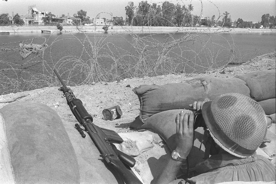
The artillery assaults on the Egyptian front made it clear that the IDF needed to find a way to protect its forces there. After a stormy debate IDF Chief of General Staff Lt.-Gen. Haim Bar-Lev decided to establish a series of forts along the entire length of the 160-kilometer Suez Canal. They would be strategic lookout posts that could alert Israel to Egyptian movements as well as provide soldiers with the best protection against shelling and snipers. The Egyptians dubbed the 32 outposts that Israel constructed between Port Said and Suez the Bar-Lev Line.
My newly recruited company was sent to the canal to help construct the Bar Lev line, setting up camp on the canal near the Mitla Junction. Our company of new recruits settled into pup tents in a small, sandy valley some 100 meters east of the canal, where construction of the outpost was commencing. Along the Suez Canal, the winter of 1967 was characterized by clear daytime skies, blazing afternoon sun, and chilly evenings illuminated solely by the moon and stars. There were no electrical lights in the vicinity. The electric grid on the western bank had been destroyed in the war. We, on the eastern side, had no desire to become targets so maintained a complete blackout at night. The dunes gleaming in the moonlight was an amazing vision for us, young soldiers pitching tents in a real desert for the first time. One night, while I was on guard duty, as I patrolled the area around the tents, I saw a beautiful fennec (desert fox) in the moonlight. It stood atop the dune above the tents, straightened its large ears, and gazed in amazement at the humans burrowing into the sands that were its home.
After an almost enchanted month at the Suez Canal, we returned to our base to finish basic training. I then proceeded to a squad commander course followed by an officer’s course at military training camp 1, which had just relocated to Mitzpe Ramon, the local Israeli desert.
The pastoral winter of 1967 came to an abrupt end. Egypt claimed that erecting a line of fortifications along the canal violated the ceasefire agreement and on March 8, 1969, while the efforts to build the Bar-Lev Line were at their peak, launched an artillery attack along the entire length of the canal. On March 9, the Israeli counterattack claimed the life of the Egyptian chief of staff, Abdul Munim Riad, and other senior officers that were visiting the headquarters on the front line of the canal. The construction of the Bar-Lev Line was completed under fire, requiring additional reinforcement of the outposts.
“We have begun the second stage of pushing Israel out of Sinai,” Egyptian President Gamal Abdel Nasser announced. “The first stage, rebuilding the army, has been completed. The second stage is harb al-astnazaf.” The literal translation of harb al-astnazaf is a blood-letting war, yet Nasser’s words were toned down in translation to “war of attrition.” In any case, in June and July 1969, this war claimed the lives of 75 IDF soldiers and wounded dozens of others. The fighting at the canal took a final toll of 367 killed and 999 wounded on the Israeli side. By the ceasefire in 1970, the number of Israelis killed on all fronts totaled 968 and the number of wounded came to 3,730. It is estimated that some 10,000 Arabs lost their lives in the War of Attrition.